Draft Local Plan-Part 2 Site Allocations
KEY SERVICE CENTRES
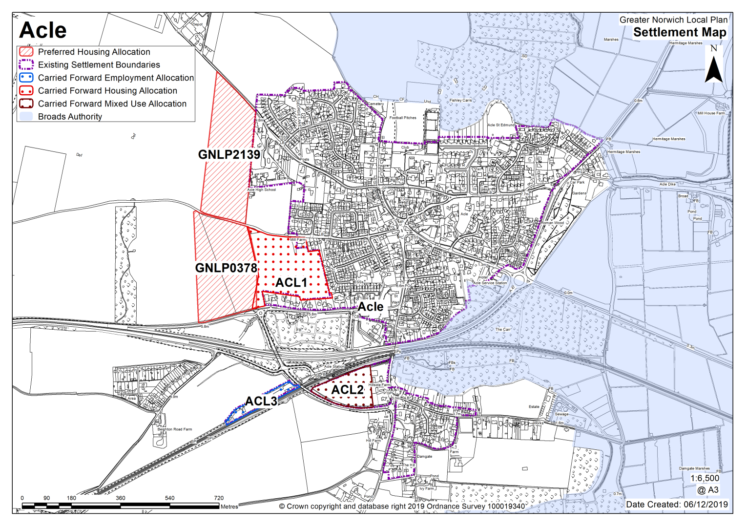
Acle is identified as a key service centre. Acle has a range of services and facilities, including a secondary school, a primary school, a small range of shops, library and bus/rail links to Norwich and Great Yarmouth. There is also limited local employment and connections to strategic employment options, although the village does have the potential to generate some additional employment by increasing its role as a gateway location to the Broads.
Acle Neighbourhood Plan was 'made' in February 2015 and covers the period to 2026. The vision for the Acle Neighbourhood Plan is to ensure that Acle continues as a flourishing village and gateway to the Broads that maintains a strong sense of community whilst embracing a sustainable and prosperous future as a place where people choose to live, work and visit.
There are two sites identified as preferred options in Acle providing for 200 new homes (100 on each). There are carried forward allocations for a total of 170 homes plus an additional 21 dwellings with planning permission on small sites. This gives a total deliverable housing commitment for Acle of 391 homes between 2018 – 2038.
All new and carried forward allocations are expected to address standard requirements associated with development. These vary from place to place but are likely to include mitigations for flood risk (as well as SUDs), highways improvements, safeguarding of minerals resources, land remediation, measures to protect the environment, biodiversity, and landscape intrusion.
|
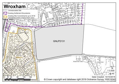
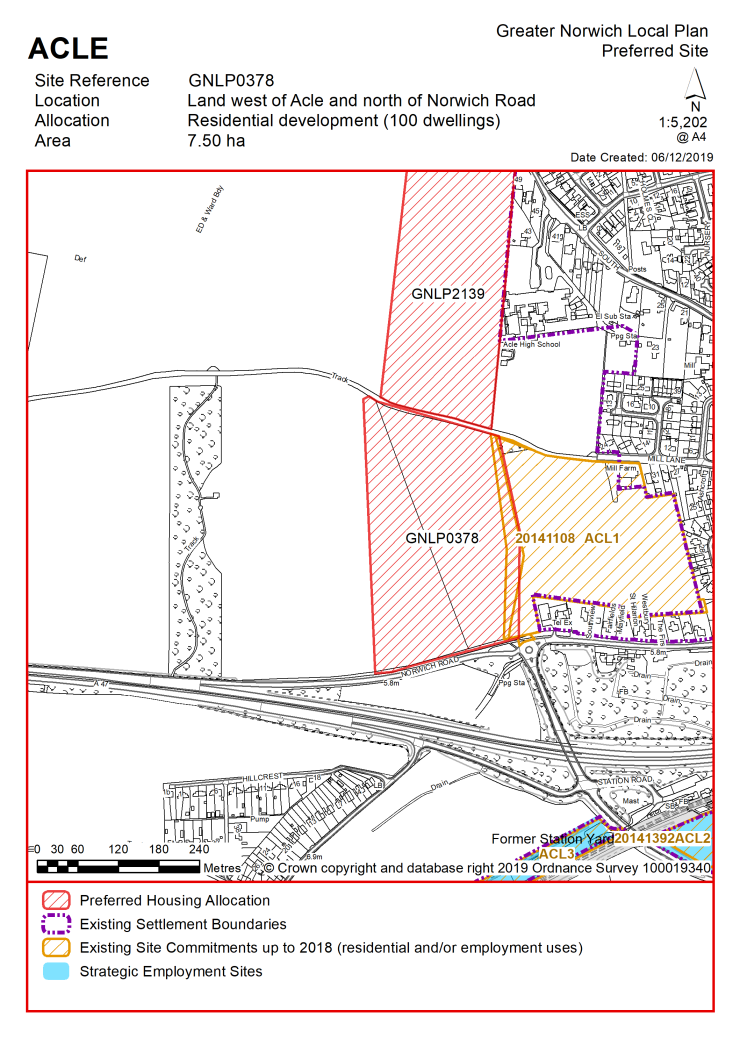
POLICY GNLP0378 Land west of Acle/North of Norwich Road (approx. 7.50 ha) is allocated for residential development. This will accommodate at least 100 homes, 33% of which will be affordable, associated open space and community facilities. More homes may be accommodated, subject to an acceptable design and layout, as well as infrastructure constraints. The development will be expected to address the following specific matters:
The masterplan should demonstrate:
|
Notes
GNLP0378: This site is preferred for allocation on a larger boundary than proposed due to the need to avoid substantial areas of flood risk (approx. 2ha). The allocation of this site subject to access via existing Broadland Local Plan allocation ACL1 and provision of pedestrian, cycle and emergency access via Mill Lane. Works to upgrade the unmade section of Mill Lane will also be required.
|
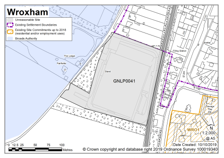
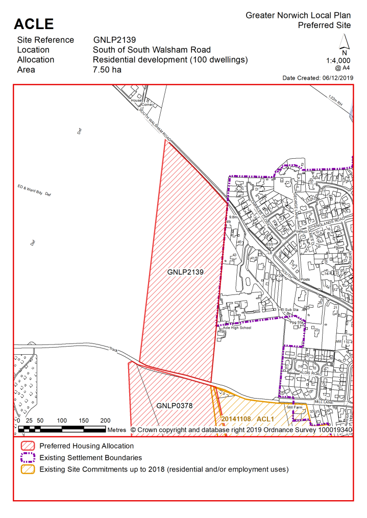
POLICY GNLP2139 Land west of Acle/North of Norwich Road (approx. 7.50 ha) is allocated for residential development. This will accommodate at least 100 homes, 33% of which will be affordable, associated open space and community facilities.
More homes may be accommodated, subject to an acceptable design and layout, as well as infrastructure constraints. The development will be expected to address the following specific matters:
The masterplan should demonstrate:
|
Notes
GNLP2139: This site is preferred for allocation on a smaller boundary than proposed. Developing the whole site would be out of scale with the existing settlement and have a landscape impact but a smaller area of the site near to the school would be more appropriate. There could be potential to provide access through the development from South Walsham Road to Mill Lane where the ACL1 allocation and the other preferred site are located, and this is considered worthy of further investigation as it may present opportunities for re-routing traffic coming into Acle along the South Walsham Road. The site does have flood risk issues associated with the reservoir to the east and this would need further investigation before development could take place.
Existing allocations carried forward
|
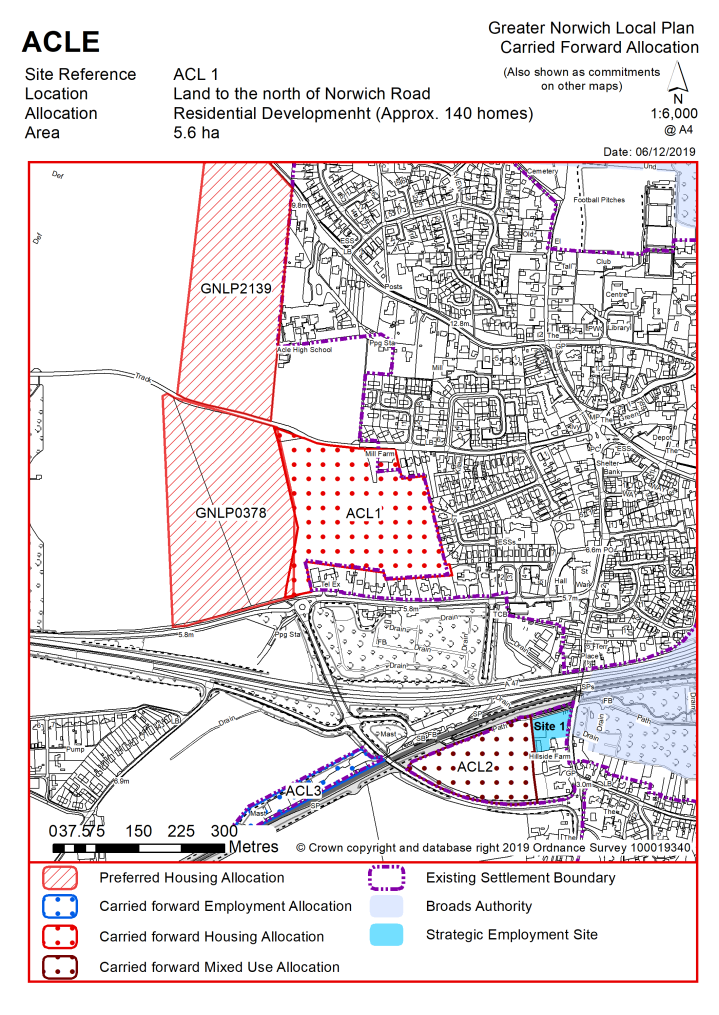
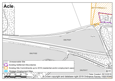
POLICY ACL1 Land to the north of Norwich Road, Acle (approx. 5.6 ha) is allocated for residential development. This will accommodate approximately 140 homes. More homes may be accommodated, subject to an acceptable design and layout, as well as infrastructure constraints. The development will be expected to address the following specific matters:
|
Notes
ACL1: The site was allocated in 2016 as part of the current local plan but has not yet been developed. The principle of development is already accepted and it is expected that development will take place within the new local plan time-period up to 2038. The site is considered in the calculation of the housing requirement, providing at least 140 homes, but more may be accommodated, subject to an acceptable design and layout, etc. being achieved. Other changes will include extending the settlement limit around ACL1 once it is completed.
|
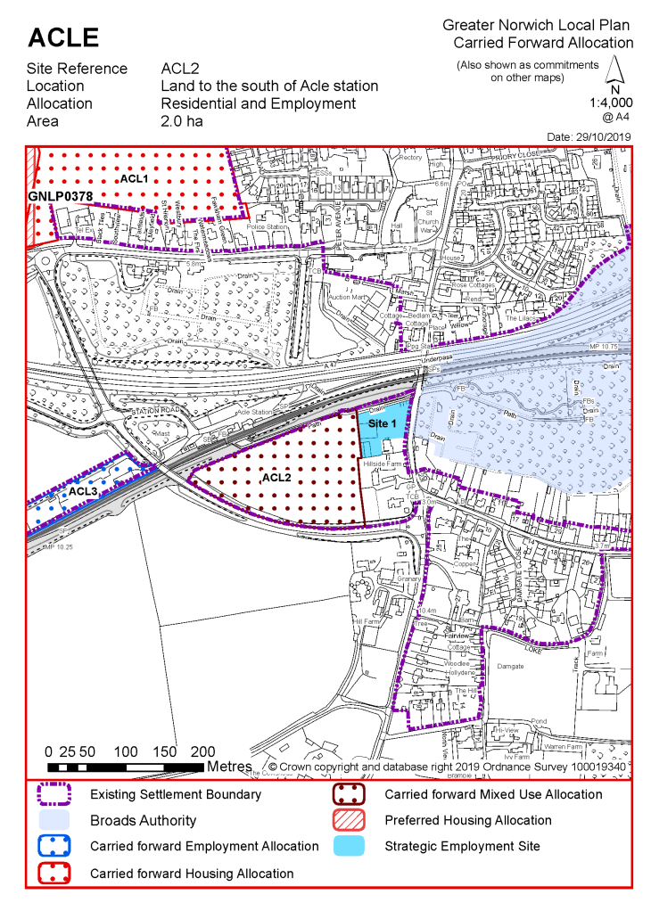
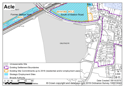
POLICY ACL2 Land to the south of Acle station, between Reedham Road and New Reedham Road (approx. 2.0 ha) is allocated for residential and employment development. This will accommodate approximately 30 homes, with the remainder for class B1 employment. The development will be expected to address the following specific matters:
|
Notes
ACL2: The site was allocated in 2016 as part of the current local plan but has not yet been developed. The principle of development is already accepted and it is expected that development will take place within the new local plan time-period up to 2038. The site is considered in the calculation of the housing requirement, providing at least 30 homes, but more may be accommodated, subject to an acceptable design and layout, etc. being achieved. Other changes will include extending the settlement limit around ACL2 once it's completed.
|
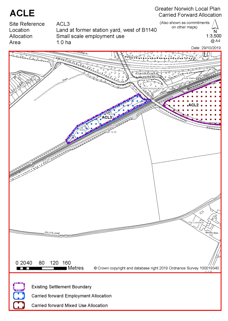
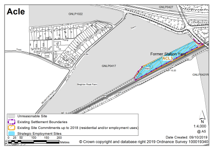
POLICY ACL3 Land at the former station yard, west of B1140, Acle (approx. 1 ha) is allocated for small scale employment use. This is likely to be within class B2. The development will be expected to address the following specific matters:
|
Notes
ACL3: The site was allocated in 2016 as part of the current local plan but has not yet been developed. The principle of development on the site has already been accepted and it is expected that development will take place within the new local plan time-period up to 2038. The site is re-allocated for employment/commercial development. Other changes will include extending the settlement limit around ACL3 once it is completed.
|
Address |
Site Reference |
Area (ha) |
Promoted for |
Reason for not allocating |
|
Acle |
||||
|
|
||||
Unreasonable Sites - Residential
|
Address |
Site Reference |
Area (ha) |
Promoted for |
Reason considered to be unreasonable |
|
Acle |
||||
| (2) | ||||
|
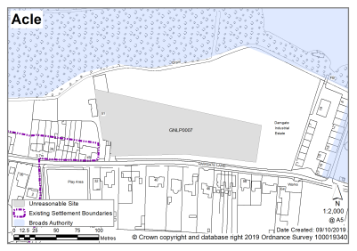
Borderland Farm, Damgate Lane |
GNLP0007 |
1.07 |
Up to 12 dwellings |
This site is not considered to be suitable for allocation as almost half the site is in flood zones 2 or 3 which would significantly affect the developable area, meaning that the site would be unlikely to meet the minimum requirement for allocation of 12-15 dwellings. There is no safe walking route to the local primary school, the site is in close proximity to the sewage works, the Broads and Damgate Wood County Wildlife Site. |
|
|
||||
| (2) | ||||
|
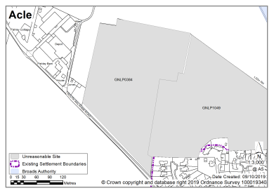
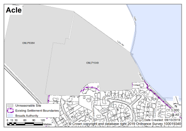
Land at Acle, South Walsham Road |
GNLP0384 |
4.88 |
145 dwellings |
This site is not considered to be suitable for allocation on highway and landscape grounds. Development would require a 2m wide footway at the north east side of South Walsham Road and insufficient highway is available to provide this. |
|
|
||||
| (1) | ||||
|
Land at Beighton Road/ Norwich Road |
GNLP0417 |
9.40 |
Approx. 204 dwellings, associated access and open space |
This site is not considered to be suitable for allocation as it is not particularly well related to services or the character of the town as it is wedged south of the A47 and north of the rail tracks. In addition, there is no safe walking route to the local primary school. |
|
|
||||
| (2) | ||||
|
Land at Jolly's Lane |
GNLP0421R |
7.00 |
Approx. 150 dwellings with open space |
This site is not considered to be suitable for allocation as it is located to the south of the A47 and the rail tracks and is therefore not particularly well related to services and facilities or the character of the town. In addition, there is no safe walking route to the local primary school. |
|
|
||||
| (1) | ||||
|
Land at Norwich Road |
GNLP0427 |
2.78 |
Mixed use residential (unspecified number) |
This site is not considered to be suitable for allocation as it is distant from the existing settlement limit and therefore not particularly well related to form and character or the services and facilities in the town. Due to its proximity to the A47 noise and pollution is also likely to be an issue. |
|
|
||||
| (1) | ||||
|
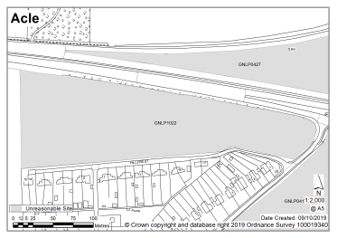
Land north of Hillcrest |
GNLP1022 |
2.90 |
Up to 60 dwellings |
This site is not considered to be suitable for allocation as it is distant from the existing settlement limit and therefore not particularly well related to form and character or the services and facilities in the town. Due to its proximity to the A47 noise and pollution is also likely to be an issue. |
|
|
||||
| (1) | ||||
|
Land north of Charles Close |
GNLP1049 |
5.40 |
Residential (unspecified number) |
This site would need to be developed with GNLP0384 to gain access and is therefore considered to be unreasonable on highway grounds as GNLP0384 requires footway provisions that are not possible within the existing highway. The development of this site would also have landscape issues. |
|
|
||||
Schedule of Corrections - This schedule will be added to if further corrections are required through the consultation process.
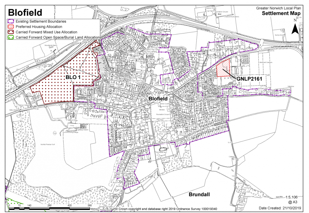
Blofield is defined as a key service centre. Services include a primary school, shop, doctor's surgery, village hall, library, and public house.
The Blofield Neighbourhood Plan was 'made' in July 2016 and covers the period to 2036. The vision for the neighbourhood plan is for the nature and character of the rural village to be preserved and retained, in order to meet various needs of residents, contribute to a high quality of life and provide opportunity and choice. This will be achieved in ways that make effective use of natural resources, enhance the environment, promote social inclusion and supports the local economy.
The figure of 353 quoted in the strategy refers to Blofield parish as a whole including Blofield Heath (but not Hemblington). In the settlement chapters, Blofield sites located south of the A47 have been counted in Blofield Key Service Centre; sites located north of the A47 have been counted as Blofield Heath and Hemblington village cluster. The distribution of figures between the two areas in the settlement chapters is shown in the tables below. For clarity, the figures highlighted in blue in 'Blofield Heath and Hemblington' have been counted in 'Blofield' in the strategy. This approach may be amended in the Regulation 19 version of the GNLP, comments are welcomed.
|
Blofield Heath & Hemblington |
Village Cluster |
|
New allocations |
15-20 |
|
Carried forward allocations |
36 |
|
PPs on other sites |
Blofield Heath: 9+8+4+1+1+1+3+1=28 Hemblington = 7 Total = 28+7=35 |
|
Total commitment (carried forward + pp) |
35+36=71 |
|
Overall Total (New and commitment) |
86-91 |
|
Blofield |
Key Service Centre |
|
New allocations |
15 |
|
Carried forward allocations |
163 |
|
PPs on other sites |
7+4+1+1+6+21+20+1+8+9+21+10+2=111 |
|
Total commitment (carried forward + pp) |
163+111=274 |
|
Overall Total (New and commitment) |
274+15=289 |
|
STRATEGY |
289 +28 + 36 = 353 |
In Blofield Key Service Centre, there is one site identified as a preferred option in Blofield providing for 15 new homes. There is one carried forward allocation BLO1 for 163 homes and a total of 111 dwellings with planning permission on other sites. This gives a total deliverable housing commitment for Blofield of 289 homes between 2018 – 2038.
All new and carried forward allocations are expected to address standard requirements associated with development. These vary from place to place but are likely to include mitigations for flood risk (as well as SUDs), highways improvements, safeguarding of minerals resources, land remediation, measures to protect the environment, biodiversity, and landscape intrusion.
|
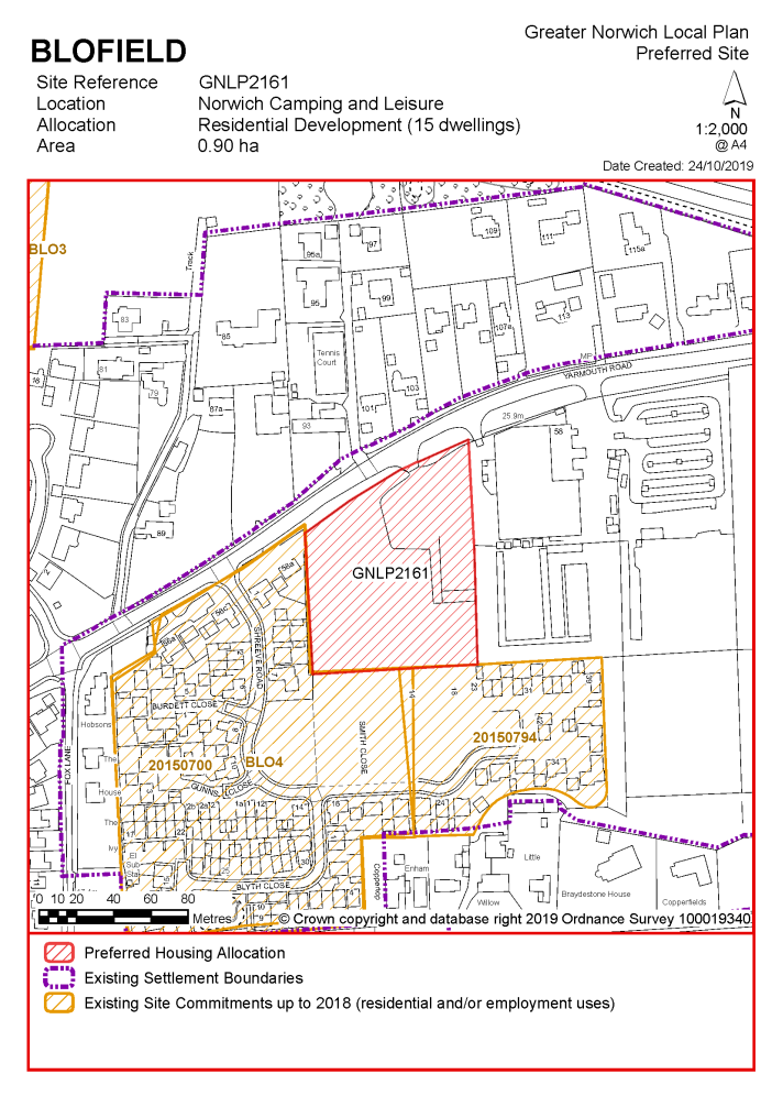
POLICY GNLP2161 Land adjacent to Norwich Camping & Leisure, off Yarmouth Road, Blofield (approx. 0.90 ha) is allocated for residential development. This site is likely to accommodate at least 15 homes, 33% of which will be affordable. More homes may be accommodated, subject to an acceptable design and layout, as well as infrastructure constraints. The development will be expected to address the following specific matters:
|
Notes
GNLP2161: Residential development in Blofield is limited due to the level of existing commitment and capacity issues with the A47 roundabout however this site is considered to be of a suitable size to allocate. The allocation is subject to provision of frontage footway and possible 'de-engineering' of the former trunk road. The promoter would need to demonstrate availability of appropriate visibility splay. Consideration will need to be given to how the site relates to the existing delivery and service yard of Norwich Camping and Leisure.
Existing allocation to be carried forward
|
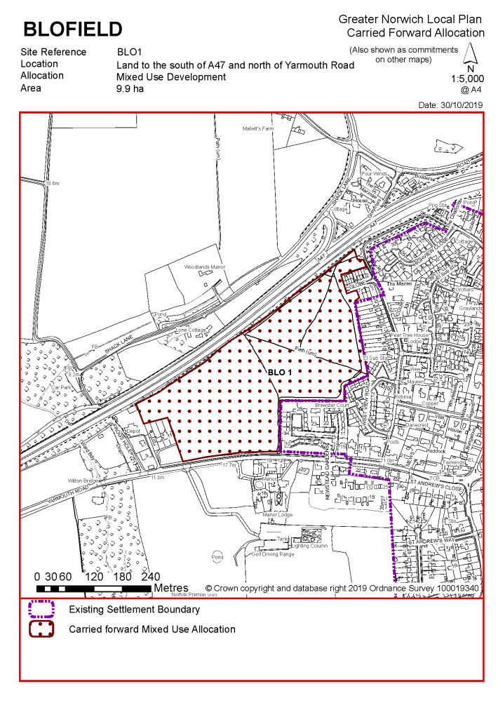
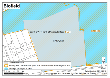
POLICY BLO1 Land to the south of A47 and north of Yarmouth Road, Blofield (approx. 9.9 ha) is to be developed in accordance with planning permission 20111303. This will include a mixed- use development to deliver 175 dwellings, a maximum floor space of 4,000 sqm B1 use class and open space.
More homes may be accommodated, subject to an acceptable design and layout, as well as infrastructure constraints. The development will be expected to address the following specific matters:
|
Notes
BLO1: The site was allocated in 2016 as part of the previous local plan but has not yet been developed. The principle of development on the site has already been accepted and it is expected that development will take place within the time-period of the new local plan up to 2038. The site is likely to accommodate at least 250 homes reflecting planning permission 20161066 which Planning Committee have resolved to grant outline approval subject to the satisfactory completion of a Section 106 Agreement and appropriate conditions. More may be accommodated, subject to an acceptable design and layout etc. being achieved. When BLO1 is completed it will be incorporated into the settlement limit.
Unreasonable Sites - Residential
|
Address |
Site Reference |
Area (ha) |
Promoted for |
Reason considered to be unreasonable |
|
Blofield |
||||
| (3) | ||||
|
Land to the south of Lingwood Road |
GNLP0082 |
4.85 |
125-149 dwellings |
This site is not considered to be suitable for allocation. Little additional growth is proposed in Blofield due to substantial existing commitment and concerns about capacity of the A47 roundabout. This site significantly exceeds that which is required and development of the scale proposed would have an adverse impact on character and appearance. |
|
|
||||
| (2) | ||||
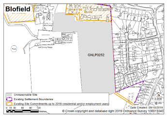
|
Land at Yarmouth Road |
GNLP0252 |
4.53 |
Residential (unspecified number) |
This site is not considered to be suitable for allocation. Little additional growth is proposed in Blofield due to substantial existing commitment and concerns about capacity of the A47 roundabout. |
|
|
||||
| (2) | ||||
|
Land north of Yarmouth Road |
GNLP2024 |
1.26 |
Residential (unspecified number) |
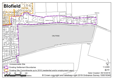
This site is not considered to be suitable for allocation. Residential development would fetter the range of uses on existing Broadland Local Plan allocation BLO1 – which have been approved through planning applications. The consequence being to reduce the potential future level and range of services in the village. Furthermore, little additional growth is proposed in Blofield due to substantial existing commitment and concerns about capacity of the A47 roundabout. |
|
|
||||
| (1) | ||||
|
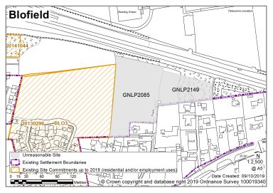
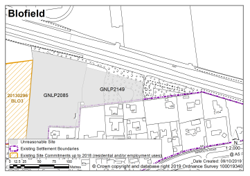
Between Yarmouth Road and A47 |
GNLP2085 |
1.15 |
30 dwellings |
This site is not considered to be suitable for allocation due to the apparent lack of access to the highway network and potential noise impacts from the A47. Furthermore, little additional growth is proposed in Blofield due to substantial existing commitment and concerns about capacity of the A47 roundabout. |
|
|
||||
| (2) | ||||
|
North of Yarmouth Road |
GNLP2149 |
0.90 |
Residential (unspecified number) |
This site is not considered to be suitable for allocation due to the apparent lack of access to the highway network. Furthermore, little additional growth is proposed in Blofield due to substantial existing commitment and concerns about capacity of the A47 roundabout. |
|
|
||||
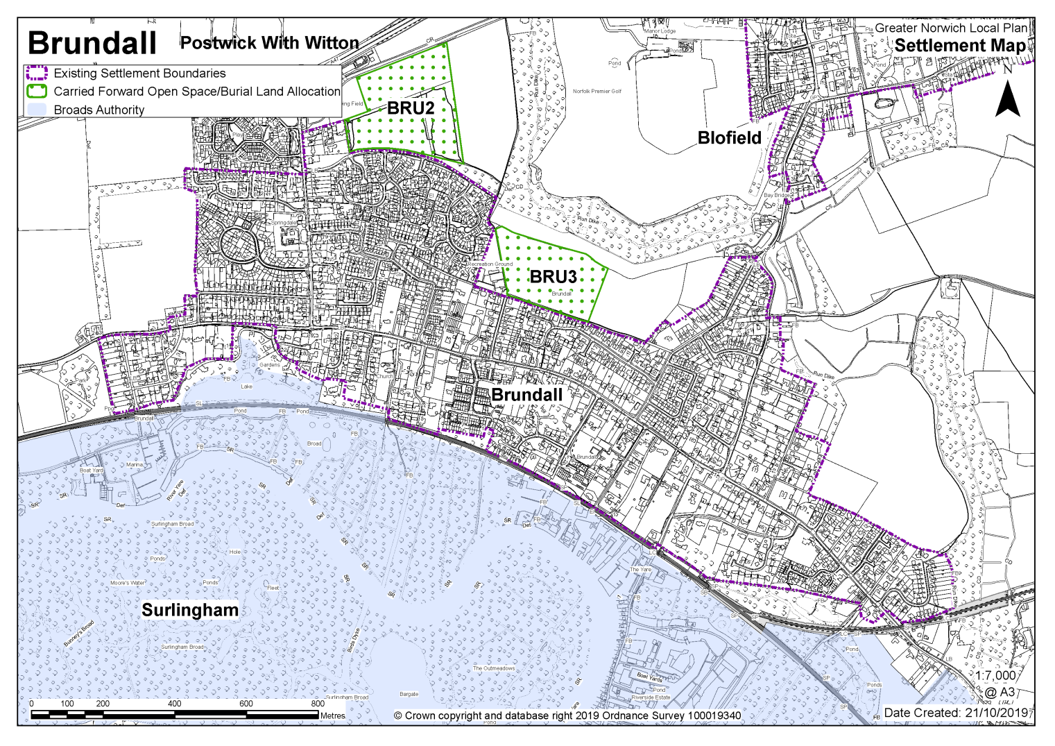
BRUNDALL (Including Postwick with Witton)
Brundall is identified as a Key Service Centre. Services include a primary school, library, doctors surgery, a food store, and public transport.
The Brundall Neighbourhood Plan was 'made' in May 2016 and covers the period to 2026. The vision for the Brundall Neighbourhood Plan is for Brundall to remain a high-quality rural village surrounded by tranquil open countryside and the Broads landscape where people want to live, visit, work and engage with a vibrant and thriving community.
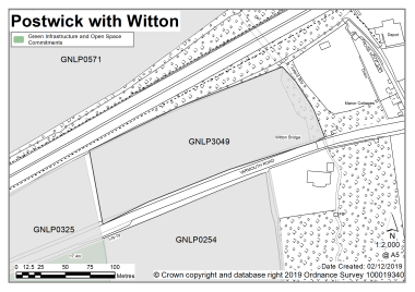
Postwick with Witton is a small village with a rural character lying predominantly to the south of the Norwich to Brundall railway line and some way to the north of the marshes adjoining the River Yare. The village has few facilities in its own right and the southern part of the parish lies within the Broads Authority Executive Area. The southern quarter of the Broadland Business Park and the Park & Ride are within Postwick Parish, but both are relatively inaccessible due to the 'barrier' created by the A47/Postwick Hub Interchange.
There are currently no new or carried forward allocations proposed in Brundall but there are 175 dwellings with planning permission. This gives a total deliverable housing commitment for Brundall of 175 homes between 2018 – 2038.
There are no sites identified as preferred options in Postwick with Witton, no carried forward allocations and 16 dwellings with planning permission on smaller sites.
All new and carried forward allocations are expected to address standard requirements associated with development. These vary from place to place but are likely to include mitigations for flood risk (as well as SUDs), highways improvements, safeguarding of minerals resources, land remediation, measures to protect the environment, biodiversity, and landscape intrusion.
No new allocations are proposed:
Notes:
Brundall has a high amount of existing development commitment and infrastructure constraints, including access to the A47 at Cucumber Lane, that limits the potential for additional housing.
Existing allocations to be carried forward
|
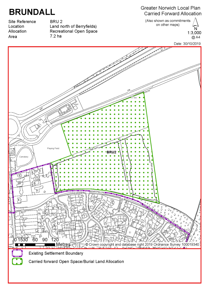
POLICY BRU2 Land north of Berryfields, Brundall (approx. 7.2 ha) is allocated for recreational open space.
The development will be expected to address the following specific matters:
|
Notes
BRU2: The site was allocated in the previous local plan and it is intended to carry this allocation forward, recognising the public benefit in providing informal open space. However, it is likely that the allocation of BRU2 will need further revision given the recent planning permission on the site for 155 dwellings which includes alternative provision for recreation (reference: 20161483). The site was also promoted through the local plan process as GNLP0325. The recreational allocation under BRU2 remains appropriate pending the residential development taking place.
|
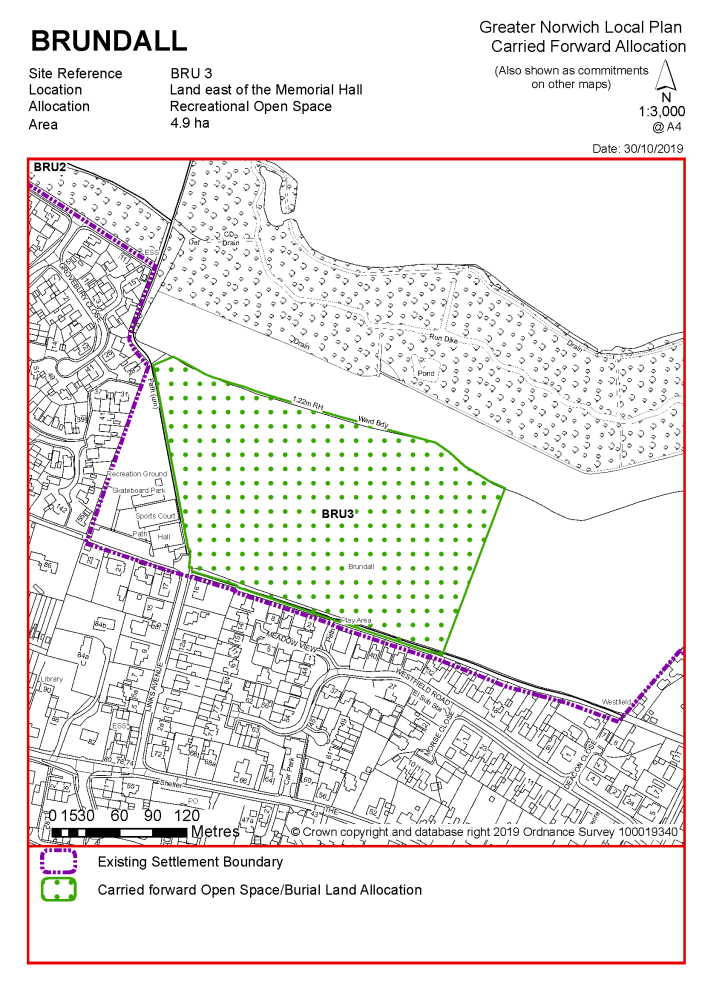
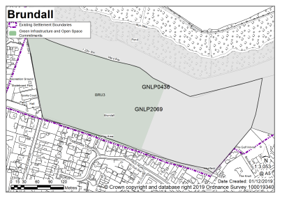
POLICY BRU3 Land east of the Memorial Hall, Brundall (approx. 4.9 ha) is allocated for recreational open space.
The development will be expected to address the following specific matters:
|
Notes
BRU3: The site was allocated in the previous local plan and it is intended to carry this allocation forward, recognising the public benefit in providing informal open space. A planning application was made for up to 170 dwellings with alternative recreation provision but was refused (reference 20171386)
Unreasonable Sites - Residential
|
Address |
Site Reference |
Area (ha) |
Promoted for |
Reason considered to be unreasonable |
|
Brundall and Postwick with Witton |
||||
| (1) | ||||
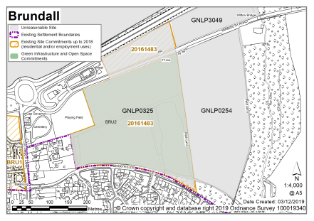
|
Land at Yarmouth Road |
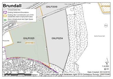
GNLP0254 |
6.62 |
Residential (unspecified number) |
This site is not considered to be suitable for allocation. Little additional growth is proposed in Brundall due to substantial existing commitment and concerns about capacity of the A47 roundabout. |
|
|
||||
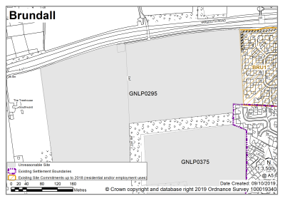
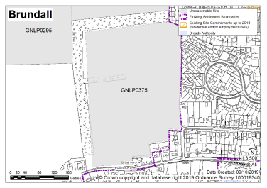
| (1) | ||||
|
Land west of Maurecourt Drive |
GNLP0295 |
12.23 |
Approx. 387 dwellings |
This site is not considered to be suitable for allocation. Little additional growth is proposed in Brundall due to substantial existing commitment and concerns about capacity of the A47 roundabout. This site is poorly related to the school and has townscape/landscape issues. Access arrangements are also unclear. |
|
|
||||
|
Yarmouth Road and Berryfield |
GNLP0325 |
8.86 |
Up to 192 dwellings and public open space. Retail supermarket and car parking spaces |
This site is not considered to be suitable for allocation as the site is already committed with an outline planning permission for retail and residential (reference 20161483). A subsequent reserved matters application has been submitted for the residential element (reference 20190604). Little additional growth is proposed in Brundall due to substantial existing commitment and concerns about capacity of the A47 roundabout. |
|
|
||||
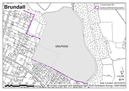
| (3) | ||||
|
Land north of Brecklands Road |
GNLP0352 |
14.67 |
Residential (unspecified number) including self-build and affordable housing with parkland and enhanced public access to Run Dike |
This site is not considered to be suitable for allocation. Little additional growth is proposed in Brundall due to substantial existing commitment and concerns about capacity of the A47 roundabout. Development on this site would have potentially significant landscape impacts. |
|
|
||||
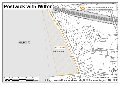
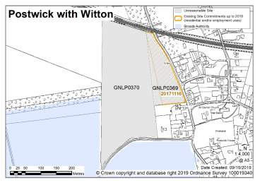
|
Land west of Oaks Lane, Postwick (Site A1) |
GNLP0369 |
1.47 |
32-48 dwellings, land for primary school and associated facilities |
This site is not considered to be suitable for allocation as it is constrained by landscape and heritage matters. In addition, there is no safe walking route to Brundall Primary School over 4km away. |
|
|
||||
|
Land west of Oaks Lane, Postwick (Site A2) |
GNLP0370 |
6.28 |
75-115 dwellings, land for primary school and associated facilities |
This site is not considered to be suitable for allocation as it is constrained by landscape, townscape and heritage matters. In addition, there is no safe walking route to Brundall Primary School which is over 4km away. |
|
|
||||
| (1) | ||||
|
Land north of Postwick Lane/ West of Holmesdale Road |
GNLP0375 |
8.91 |
Approx. 200-250 dwellings, open space and possible community facilities |
This site is not considered to be suitable for allocation. Little additional growth is proposed in Brundall due to substantial existing commitment and concerns about capacity of the A47 roundabout. The development of this site would raise landscape and townscape concerns. |
|
|
||||
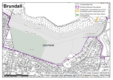
| (7) | ||||
|
Land north of Links Avenue |
GNLP0436 |
17.17 |
Up to 250 dwellings plus open space, recreation and leisure uses |
This site is not considered to be suitable for allocation. The site is subject to a current planning application (reference 20171386) for 170 dwellings and associated recreational space and green infrastructure. Little additional growth is proposed in Brundall due to substantial existing commitment and concerns about capacity of the A47 roundabout. |
|
|
||||
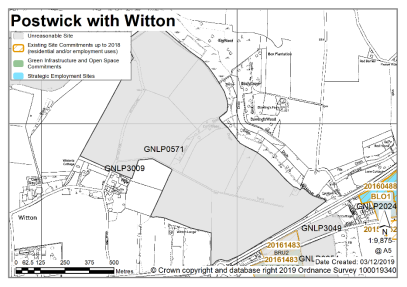
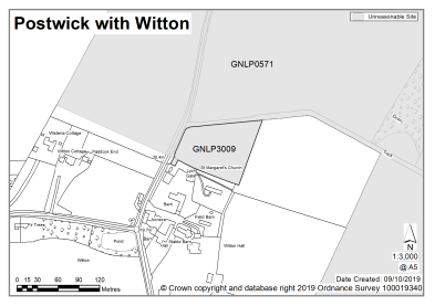
| (2) | ||||
|
Land north of the A47, North and East if Witton Hall and west of Dawlings Wood, Postwick |
GNLP0571 |
65.48 |
New village with access off A47 and links to Little Plumstead |
Constraints exist in respect to issues of access, impact on the road network, landscape, townscape, ecological designations, and heritage assets. The submitted information gives no indication that the necessary infrastructure and mitigations can be overcome. On this basis the site is not considered to be suitable for allocation. GNLP0571 is also out of step with the strategic proposals in the plan. |
|
|
||||
|
East of Witton Lane, Postwick |
GNLP3009 |
0.77 |
Residential development, 4-5 dwellings |
This site is not considered to be suitable for allocation as it is remote with no safe walking route to the local primary school in Brundall. |
|
|
||||
Unreasonable Sites - Non-Residential
|
Address |
Site Reference |
Area (Ha) |
Proposal |
Reason considered to be unreasonable
|
|
Brundall (including Postwick) |
||||
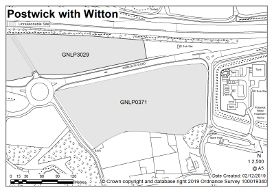
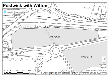
|
Land south A1042 Yarmouth Road, Postwick |
GNLP0371 |
3.08 |
Commercial |
This site is not preferred for allocation as consent has already been given under planning application reference 20180504. |
|
|
||||
| (3) | ||||
|
East of Brundall Memorial Hall, Brundall |
GNLP2069 |
8.67 |
Recreation and Leisure |
A planning application on this site (reference 20171386) for 170 dwellings, sports pavilion, country park and outdoor recreation was refused in July 2019. This means that existing open space allocation BRU3 from the Broadland Local Plan will be carried forward but on a smaller boundary than this site. It is not proposed to enlarge the area of the BRU3 allocation so this site is considered to be unreasonable for allocation. |
|
|
||||
|
Land adjacent Postwick Interchange, Postwick with Witton |
GNLP3029 |
3.12 |
Mixed use including leisure, roadside, retail |
This site is well located, being surrounded on all sides by strategically important roads. To the immediate west is the Postwick Interchange and the site itself would be accessed from the A1042. At the time of writing a planning application (reference 20190300) has been submitted for a petrol filling station and two drive through restaurants. This site is not preferred for allocation as it is recognised that a proposal of this nature is better dealt with through the development management process. |
|
|
||||
|
Land North of Yarmouth Road, Brundall |
GNLP3049 |
1.71 |
Employment |
This site has the potential to provide local employment opportunities but is not preferred for allocation at the current time. To justify a local plan allocation in this location more evidence would be required about the need for the proposal and how it would be delivered. A proposal of this scale would probably be better dealt with through the planning application process. |
|
|
||||
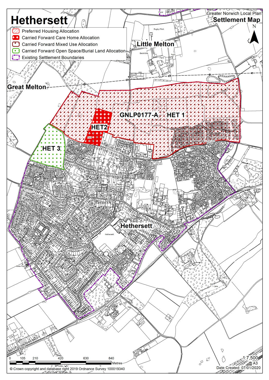
Hethersett is identified as a key service centre. There are existing allocations and planning permissions in place for development across the north of the village.
In terms of education facilities, proposals are underway to have two primary schools (one at Queen's Road and the other on Coachmakers Way); and, to expand the site of the secondary school. This will add to the good range of facilities already available in Hethersett. These include: convenience shops, a post office, a pharmacy, doctor and dentist surgeries, a library and a small business centre, mostly in the vicinity of Queen's Road/Great Melton Road. More generally in terms of the built form, the old A11 (B1172 Norwich Road) still largely defines the settlement's built edge to the south. To the east and west of Hethersett land is controlled by a long-standing strategic gap policy to prevent coalescence with Cringleford to the east and Wymondham to the west.
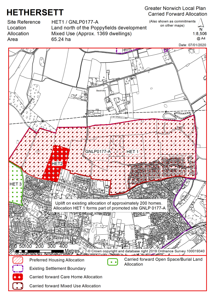
There are currently no new allocations proposed in this key service centre. There is one carried forward residential allocation for a total of 1369 homes (including 200 uplift) there are currently no additional dwellings with planning permission on small sites. This gives a total deliverable housing commitment for the centre of 1369 homes between 2018 – 2038.
All new and carried forward allocations are expected to address standard requirements associated with development. These vary from place to place, but are likely to include mitigations for flood risk (as well as SUDs), highways improvements, safeguarding of minerals resources, land remediation, measures to protect the environment, biodiversity, and landscape intrusion.
(1) No new allocations are proposed
Notes:
A substantial commitment of development remains and the need for more housing can be met from an uplift on the existing allocation.
Existing allocations to be carried forward
|
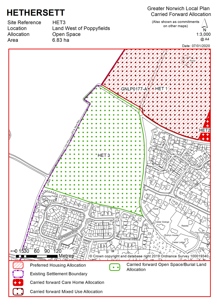
Policy HET 1 (part of GNLP0177-A): Land north Hethersett The site lies to the north of the Poppyfields development, the plant nursery on Grove Road, Longview, the village hall and Back Lane, and south of Beckhithe Meadow County Wildlife Site (CWS), Holly Tree Farm and south-west of Braymeadow CWS. Due to the size of this allocation, a range of supporting infrastructure and facilities will be required, and the site should be masterplanned to maximise integration with the existing settlement and other allocations in Hethersett. Approximately 65 ha is allocated for mixed use, to include housing, community uses, open space and green infrastructure. This will include approximately 1,369 dwellings. The developer(s) of the site will be required to ensure the following: Masterplan and Phasing Plan
infrastructure and highway improvements, including Thickthorn junction.
Enhanced Facilities
Landscaping and Green Infrastructure
Transport
Site Conditions and Constraints
|
Notes
HET 1: GNLP0177-A to the north and west of Hethersett, which incorporates the existing allocation HET 1, far exceeds the land required for development in Hethersett. Instead, the preferred approach is not to allocate new land for development but to uplift the HET 1 allocation from the 1,196 homes already permitted to an approximate total 1,369 homes, incorporating part of GNLP0177-A. The remainder of GNLP0177-A is not preferred for allocation. Development on HET 1 is well-advanced and it has become apparent from the approved reserved matters planning applications that an uplift of approximately 200 dwellings is a realistic prospect. There are no major constraints to accommodating an uplift of 200 homes, subject to ensuring delivery of the policy requirements set out in HET 1, and the mitigation measures already agreed through the approved planning applications. In terms of transport, improvements needed would be an access strategy for all modes of transport, safeguards against increasing traffic through Little Melton, and a cycle link to Colney Lane.
|
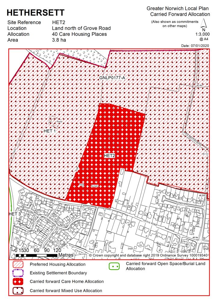
Policy HET 2 Land north of Grove Road This site includes the plant nursery and adjacent land forming the curtilage of 36 Grove Road. The JCS identifies a need for mixed tenure housing with care in Hethersett. Land amounting to some 3.8 hectares is allocated for at least 40 places of 'extra care housing', or a different figure in line with the most up to date needs assessment. Vehicular access will need to be from the north of the site, via HET1. The developer of the site is required to ensure the following:
|
Notes
HET 2: The site was allocated in 2015 as part of the current local plan but has not yet been developed, as the phase of development of the HET1 allocation required to access the site has not yet progressed. The principle of development is already accepted and it is expected that development will take place within the new local plan time-period. The boundary and policy requirements of HET 2 are unchanged from the original allocation, but opportunity does exist for revision. At 3.8 ha HET 2 contains more land than is needed for a 40 place 'extra care' housing scheme, and subject to the suitability of uses proposed, additional development on HET 2 could be acceptable; this could include additional extra care units or care home provision based on the most up to date assessment of need, or if additional care need is not identified, further market and affordable housing.
|
Policy HET 3: land west of Poppyfields This site lies to the south-west of HET 1 policy area, and to the west of the Poppyfields development, and is underlain by a significant archaeological site. The Historic Environment Service has advised that informal open space would be the preferred use here. Permission has been granted to use part of the site as an access road to HET 1. The remainder of the site should remain open and undeveloped to protect the archaeological remains. In this context the site has the potential to be used as open space in connection with housing development at HET 1 and HET 2. The land amounts to approximately 6.5ha. In bringing forward the site for informal open space, it should be ensured that:
|
Notes
HET 3: The site has not been brought forward as part of the current permitted development on the HET 1 allocation; however, the proposed increase in numbers on both HET 1 and HET 2 mean that additional supporting infrastructure, including green infrastructure, may be necessary. It is therefore proposed to carry forward the existing allocation HET 3, recognising the public benefit in providing informal open space, and also to safeguard the archaeological interest relating to the land.
|
Address |
Site Reference |
Area (ha) |
Promoted for |
Reason for not allocating |
|
Hethersett |
||||
| (2) | ||||
|
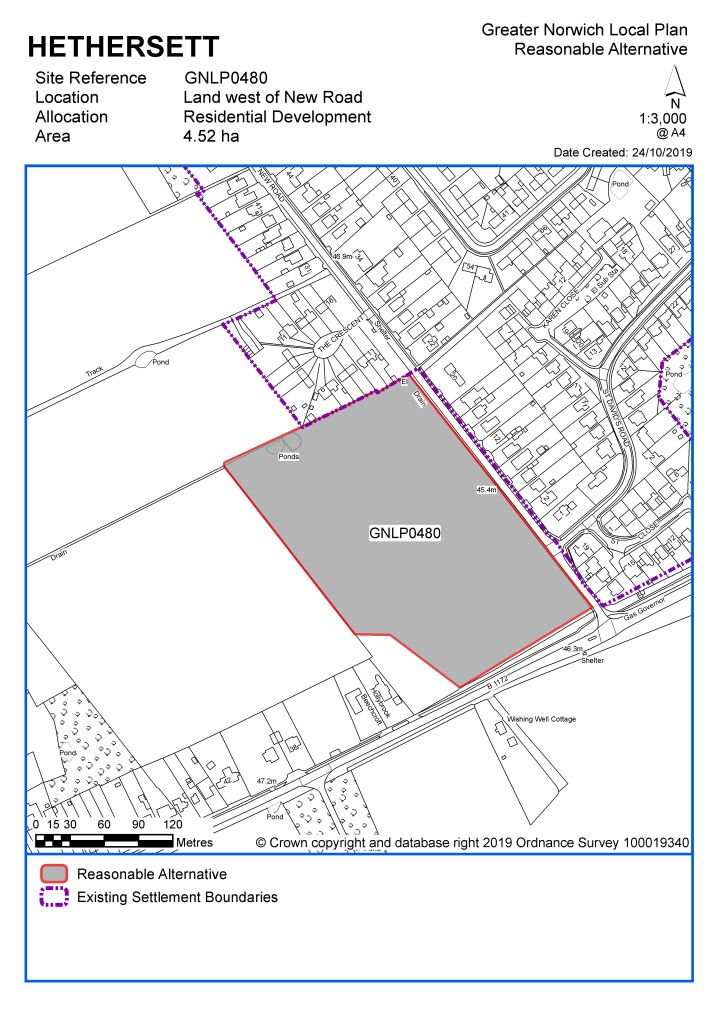
Land west of New Road |
GNLP0480 |
4.52 |
Approx. 42 dwellings and/or sheltered housing and/or housing with care |
This site is considered to be a reasonable alternative if additional growth is needed in key service centres. Amongst the mitigations would be provision of a 3 metre wide shared-use footway/cycleway at the, and connecting to the existing footpath facility along the B1172. The site is within the strategic gap between Hethersett and Wymondham, however as it is reasonably well related to the existing settlement adjacent to the settlement limit, this would not necessarily preclude a sensitively designed development through a new Local Plan allocation. |
Unreasonable Sites - Residential
|
Address |
Site Reference |
Area (ha) |
Promoted for |
Reason considered to be unreasonable |
|
Hethersett |
||||
| (2) | ||||
|
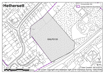
Wood Hall, Norwich Road |
GNLP0135 |
1.98 |
Residential (unspecified number) |
This site is not considered to be suitable for allocation as it is not acceptable to access the B1172 at this point. There are constraints too in terms of onsite trees and impacts on the setting of Wood Hall. |
|
|
||||
| (3) | ||||
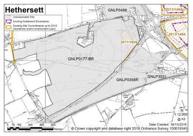
|
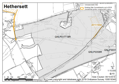
Land to south east of Hethersett |
GNLP0177BR |
103.21 |
Renewable energy generation, offices, residential short stay units, green infrastructure, hotel, care home |
|
|
|
||||
| (2) | ||||
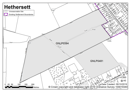
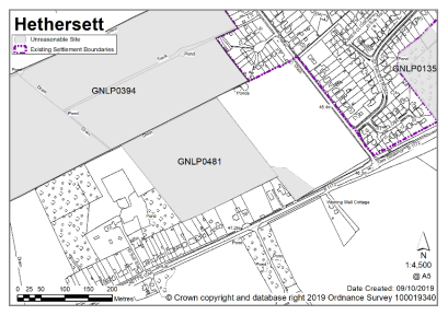
|
Land at New Road |
GNLP0394 |
15.06 |
Approx. 300 dwelling |
This site is not considered to be suitable for allocation due to highways constraints, unless developed in conjunction with adjacent sites GNLP0480 and 0481. Parts of the site may be affected by surface water flooding which could limit the location and scale of development. The site is also within the strategic gap between Hethersett and Wymondham. GNLP0394 could only be considered as a single allocation with GNLP0480 and GNLP0481. |
|
|
||||
| (1) | ||||
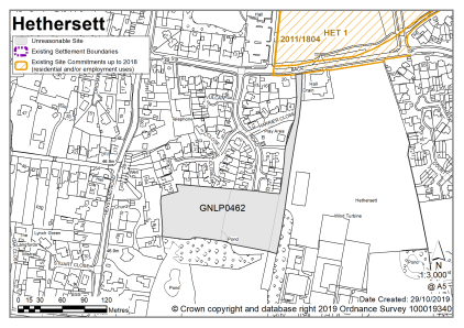
|
Land off Jaguar Road |
GNLP0462 |
1.34 |
Approx. 20 dwellings with open space |
This site is centrally located in the village and is within an area identified as an important local open space in the South Norfolk Local Plan. Proposed residential development on the site has been rejected on appeal in the past, with the reason that development would harm the openness of the site therefore the site is not considered to be suitable for allocation. |
|
|
||||
| (1) | ||||
|
Land west of New Road |
GNLP0481 |
4.92 |
Residential care home, sheltered housing and/or housing extra care for the elderly and public open space of 3.18ha (extension to park proposed on adjoining site |
This site is not considered to be suitable for allocation due to highways constraints. GNLP0481 could only possibly come forward with GNLP0480. Furthermore, the site is within the strategic gap between Hethersett and Wymondham. |
|
|
||||
| (1) | ||||
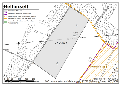
|
West of Hethersett (partly in Great Melton Parish) |
GNLP3030 |
8.10 |
Residential (unspecified number) |
This site is not considered to be suitable for allocation as it is divorced from the settlement. It is located in the countryside and distant from the facilities in Hethersett with no pedestrian footways to access them. |
|
|
||||
|
Unreasonable Sites - Non-Residential
|
||||||||||
|
Address |
Site Reference |
Area (Ha) |
Proposal |
Reason considered to be unreasonable
|
||||||
|
Hethersett (including Thickthorn) |
||||||||||
| (2) | ||||||||||
|
Land around Thickthorn Roundabout. Either side of A11 |
GNLP0177-BR / GNLP0358R |
134.00 |
Outdoor leisure, residential care assisted living, renewable energy generation |
This site is not preferred for allocation as although the A11 is strategically important for growth there are already significant allocations and commitments in place nearby at Colney, Cringleford and Hethersett and further land of this scale is not needed at the current time. This site includes heritage assets such Thickthorn Hall set within historic parkland. It is also within the strategic gap separating Hethersett and Cringleford and the Norwich Southern Bypass Landscape Protection Zone. |
||||||
|
|
||||||||||
| (1) | ||||||||||
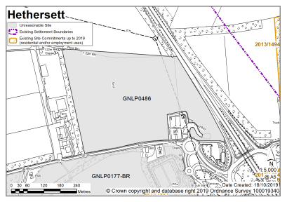
|
Land north of Norwich Road, Hethersett |
GNLP0486 |
14.83 |
Employment |
This site is not considered to be suitable for allocation as evidence suggests that currently committed land is more than sufficient in quantity and quality to meet the employment growth needs in Greater Norwich. There is therefore no need to allocate any additional large-scale employment sites in the new local plan. Development in this location would impact on the Southern Bypass Landscape Protection Zone and the strategic gap between Hethersett and Cringleford. |
||||||
|
|
||||||||||
| (2) | ||||||||||
|
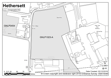
Little Melton Business Park - Site A (land to west) |
GNLP1023-A |
2.90 |
Food-led industrial |
This site is not considered to be suitable for allocation as evidence suggests that currently committed land is more than sufficient in quantity and quality to meet the employment growth needs in Greater Norwich. There is therefore no need to allocate any additional large-scale employment sites in the new local plan. |
||||||
|
|
||||||||||
| (2) | ||||||||||
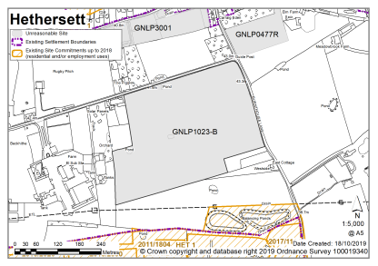
|
Little Melton Business Park - Site B (land to east) |
GNLP1023-B |
10.70 |
Food-led industrial |
This site is not considered to be suitable for allocation as evidence suggests that currently committed land is more than sufficient in quantity and quality to meet the employment growth needs in Greater Norwich. There is therefore no need to allocate any additional large-scale employment sites in the new local plan. |
||||||
|
|
||||||||||
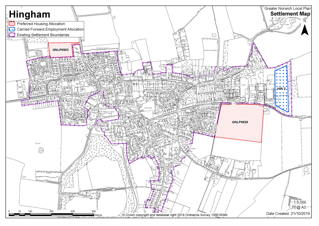
Hingham is identified as a key service centre in the GNLP. Local services within Hingham include a primary school, GP practice, community buildings, employment opportunities and a food shop. Hingham is well served by public transport, connecting to Wymondham and Norwich.
Hingham stands on a low ridge separating the Blackwater valley to the north and the low-lying area of Hall Moor to the south. It has an attractive centre of significant historic and architectural value based around the open areas of The Fairland and Market Place and overlooked by the church which dominates the skyline from distant views. As such, the development boundary excludes the wooded grounds of The Rectory, St Andrews Church and churchyard, the grounds of St Andrews Lodge and The Fairland, as these areas make an important contribution to the character of the town.
Two sites are identified as preferred options providing for at least 100 new homes in the key service centre (one for 80 homes, one for 20 homes). There are no carried forward residential allocations and a total of 16 additional dwellings with planning permission on small sites. This gives a total deliverable housing commitment for the key service centre of 116 homes between 2018 – 2038.
All new and carried forward allocations are expected to address standard requirements associated with development. These vary from place to place, but are likely to include mitigations for flood risk (as well as SUDs), highways improvements, safeguarding of minerals resources, land remediation, measures to protect the environment, biodiversity, and landscape intrusion.
|
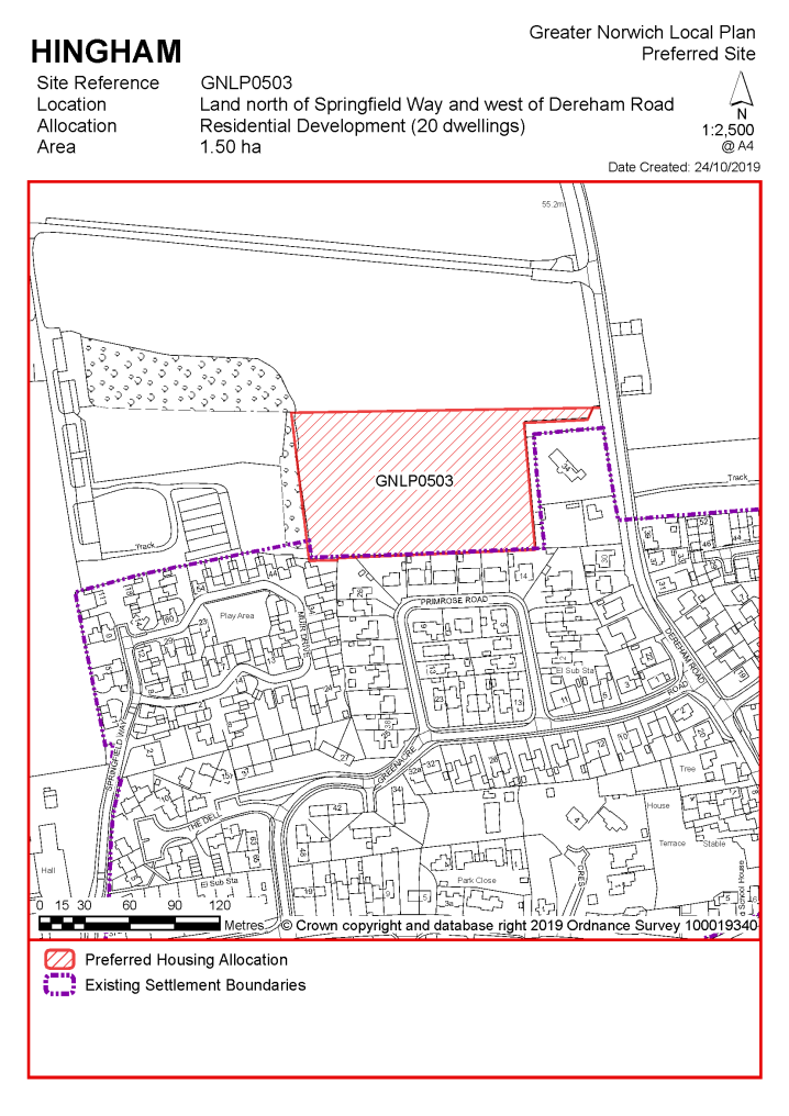
POLICY GNLP0503 Land north of Springfield Way and west of Dereham Road, Hingham (approx. 1.50 ha) is allocated for residential development. This will accommodate at least 20 homes, 33% of which will be affordable. More homes may be accommodated, subject to an acceptable design and layout being achieved, and any infrastructure issues addressed.
The development will be expected to address the following specific matters:
|
Notes
GNLP0503: This site is proposed for allocation on a reduced boundary. Development of up to 20 dwellings would be acceptable subject to provision of a safe access and a continuous footway at the west side of Dereham Road from the site access to Pottles Alley. A 30mph speed limit extension would be required to include the site frontage. Minor carriageway widening may also be required.
|
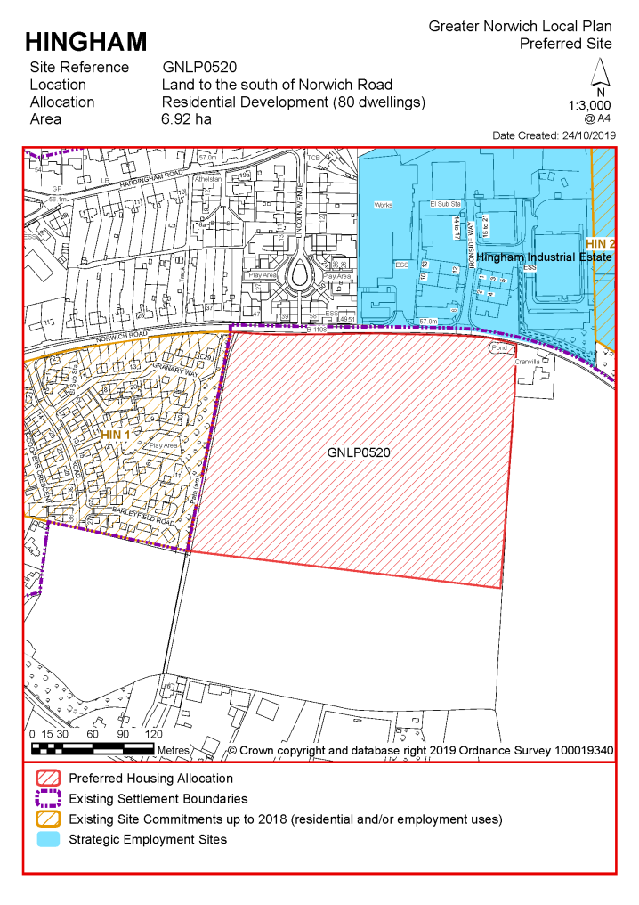
POLICY GNLP0520 (part of) Land south of Norwich Road, Hingham (approx. 6.92 ha) is allocated for residential development. This will accommodate approximately 80 homes, 33% of which will be affordable. More homes may be accommodated, subject to an acceptable design and layout being achieved, and any infrastructure issues addressed. .
The development will be expected to address the following specific matters:
|
Notes
GNLP0520: This site is proposed for allocation on a reduced boundary to avoid areas of surface water flood risk and historic environment impacts. The site is well located on the approach into the village adjacent to the existing allocated site. The allocation is subject to provision of adequate visibility splays and layout of the development to create an active frontage at B1108. Footways need to be provided at the site frontage, along with a pedestrian crossing refuge in the vicinity of Ironside Way. Consideration should also be given to connectivity with PROW Hingham F9.
Existing allocations to be carried forward
|
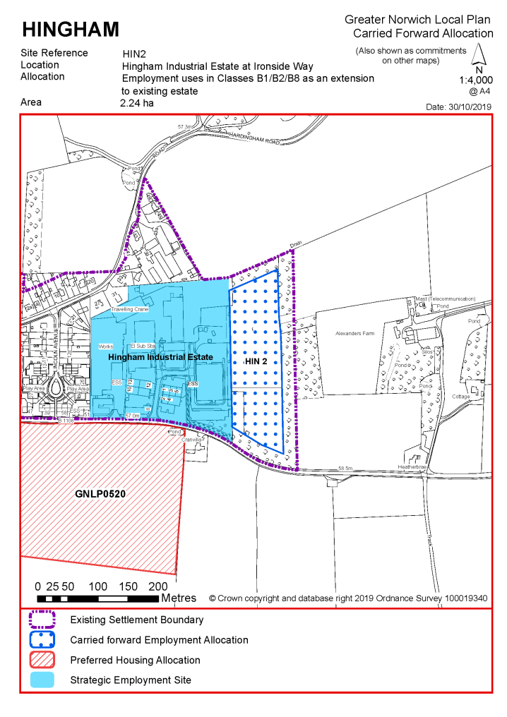
POLICY HIN2 Land adjacent to Hingham Industrial Estate at Ironside Way, Hingham (approx. 2.24 ha) is allocated for employment uses in Classes B1/B2/B8 as an extension to the existing industrial estate.
The development will be expected to address the following specific matters:
|
Notes
HIN2: The site was allocated in 2015 as part of the current local plan but has not yet been developed. The principle of development on the site has already been accepted and it is expected that development will take place within the new local plan time-period. The site is re-allocated for employment/commercial development.
|
Address |
Site Reference |
Area (ha) |
Promoted for |
Reason for not allocating |
|
Hingham |
||||
| (1) | ||||
|
NO REASONABLE ALTERNATIVE SITES
|
||||
Unreasonable Sites - Residential
|
Address |
Site Reference |
Area (ha) |
Promoted for |
Reason considered to be unreasonable |
|
Hingham |
|
|
|
|
| (2) | ||||
|
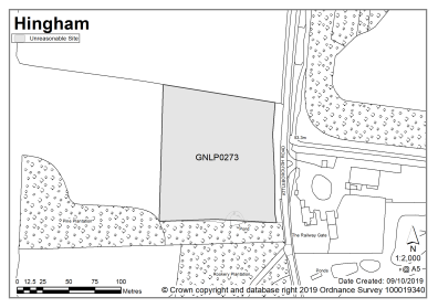
Land west of Attleborough Road |
GNLP0273 |
1.33 |
Residential (unspecified number) |
This site is not considered to be suitable for allocation as it is located some way from the existing settlement limit with no safe walking route to the local primary school. |
|
|
||||
| (8) | ||||
|
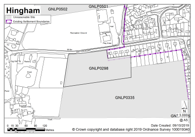
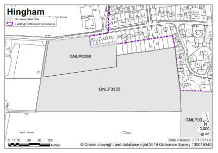
Land opposite Hingham Sports Centre, Watton Road |
GNLP0298 |
1.87 |
Approx. 50-100 dwellings |
This site is not considered to be suitable for allocation as development here would extend the settlement further west along the B1108. It is not possible to get an adequate footway link from the site into Hingham Town centre. |
|
|
||||
| (4) | ||||
|
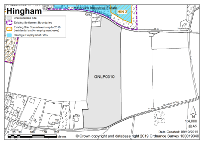
Land south of Norwich Road, north of Seamere Road |
GNLP0310 |
5.65 |
Approx. 172 dwellings |
This site is not considered to be suitable for allocation at the current time as it would need to be developed in conjunction with, or following site GNLP0520 otherwise development would be separate from the existing built form of the settlement. There are concerns about forward visibility; it is unlikely that adequate vehicular access could be provided without a safety concern. |
|
|
||||
| (5) | ||||
|
Land south of Watton Road |
GNLP0335 |
5.81 |
Approx. 100-200 dwellings |
This site is not considered to be suitable for allocation as it would make an odd, backland form of development without the allocation of site GNLP0298, which is also considered to be unreasonable on highway grounds. |
|
|
||||
| (3) | ||||
|
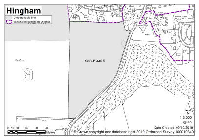
Land west of Attleborough Road |
GNLP0395 |
3.99 |
Approx. 200 dwellings |
This site is not considered to be suitable for allocation as Attleborough Road is considered too constrained and not suitable for intensification of use. The footways are narrow and there is no scope for improvement. Development of this site would also have landscape and heritage impacts. |
|
|
||||
| (2) | ||||
|
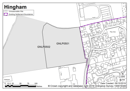
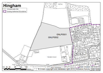
Land west of Springfield Way |
GNLP0501 |
1.32 |
Approx. 41 dwellings with associated new public open space |
Despite a safe pedestrian route to the primary school, the site is not considered to be suitable for allocation due to the absence of an acceptable vehicular access on to Springfield Way. |
|
|
||||
| (2) | ||||
|
Land west of Springfield Way |
GNLP0502 |
3.86 |
Approx. 91 dwellings with associated new public open space |
Despite a safe pedestrian route to the primary school, the site is not considered to be suitable for allocation due to the absence of an acceptable vehicular access on to Springfield Way. The site area is constrained by flood risk and development in this location would encroach into open countryside with a resulting impact on form and character. |
|
|
||||
| (13) | ||||
|
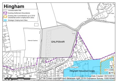
Swan Field, Hardingham Road |
GNLP0544R |
2.96 |
Up to 96 dwellings |
This site is not considered to be suitable for allocation due to highways constraints. The narrowness of the carriageway and the lack of a continuous footpath is compounded by the very poor forward visibility for vehicles travelling around the adjacent bend on Hardingham Road. |
|
|
||||
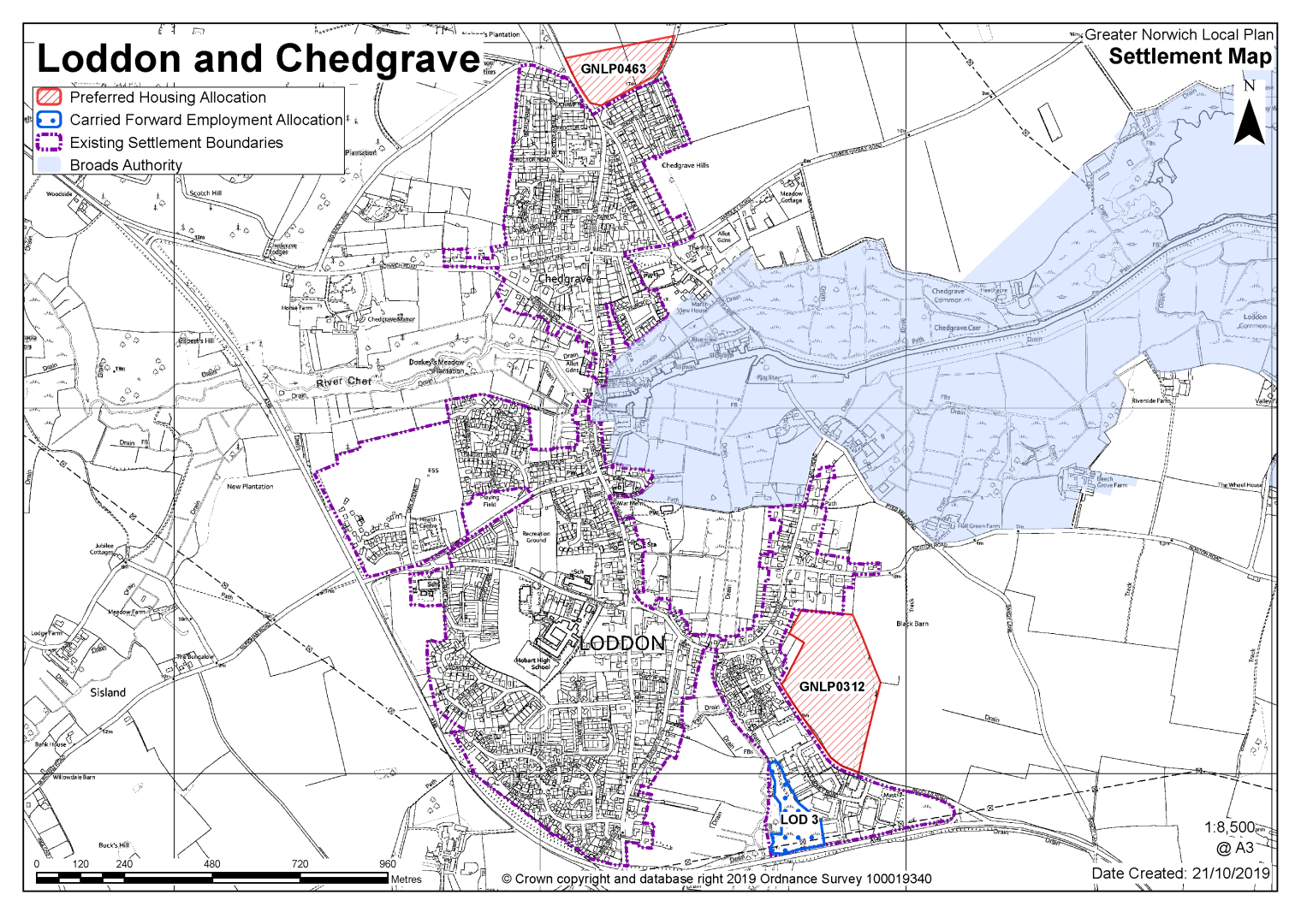
The combined settlement of Loddon and Chedgrave is identified as a key service centre in the GNLP. There is a range of services including shops, infant, junior and high school, medical centre, library, public houses and industrial estate. The settlement is well served by buses linking to Norwich, Beccles and Lowestoft, and a development of 200 homes north of George Lane, Loddon is currently being progressed.
Issues to take into account when assessing the potential for future development include a substantial Conservation Area covering the town centre of Loddon and extending into Chedgrave, plus a separate Conservation Area around the Church of All Saints. The town centre is characterised by closely built up streets, interspersed with important open spaces, such as Church Plain. The Broads Authority area extends into the town centre, along the valley of the River Chet. The A146 bypass defines the extent of the settlement to the south and west, with the river valley that separates Low and High Bungay Road from the development off Beccles Road providing a noticeable green break.
Two sites are identified as preferred options providing for at least 200 new homes in the key service centre (one for 180 homes, one for 20 homes). There are no carried forward residential allocations and a total of 200 additional dwellings with planning permission. This gives a total deliverable housing commitment for Loddon and Chedgrave of 400 homes between 2018 – 2038.
All new and carried forward allocations are expected to address standard requirements associated with development. These vary from place to place but are likely to include mitigations for flood risk (as well as SUDs), highways improvements, safeguarding of minerals resources, land remediation, measures to protect the environment, biodiversity, and landscape intrusion.
|
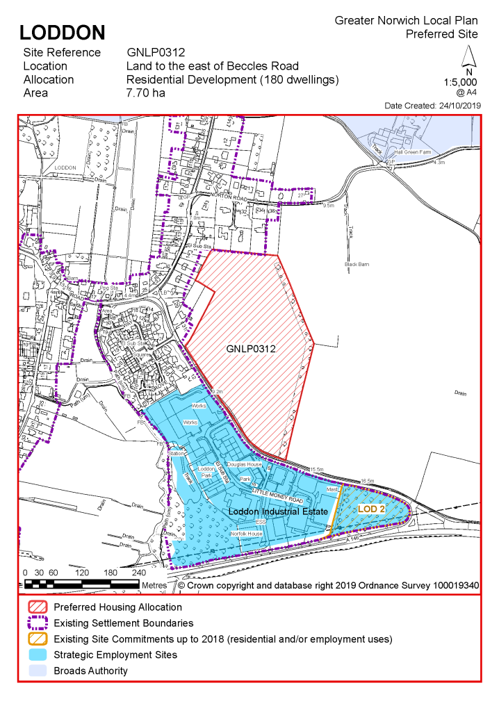
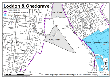
POLICY GNLP0312 Land to the east of Beccles Road Loddon (approx. 7.70 ha) is allocated for residential development. This site is likely to accommodate at least 180 homes, 33% of which will be affordable. More homes may be accommodated, subject to an acceptable design and layout being achieved and any infrastructure issues addressed. The development will be expected to address the following specific matters:
|
Notes
GNLP0312: This site is preferred for allocation as it is well related to the form and character of the settlement and is less constrained than other sites promoted, which raise access or townscape and heritage concerns. The allocation is subject to two points of access. The site rises to the north so development on this site would be significantly more visible in the landscape than the dwellings and units opposite, and the design of the development would need to address the issues with the topography of the site.
|
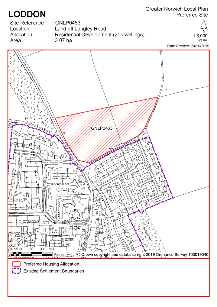
POLICY GNLP0463 Land off Langley Road, Chedgrave (approx. 3.07 ha) is allocated for residential development. This site is likely to accommodate at least 20 homes, 33% of which will be affordable. More homes may be accommodated, subject to an acceptable design and layout being achieved and any infrastructure issues addressed. The development will be expected to address the following specific matters:
|
Notes
GNLP0463: Although this site is elevated and would be quite prominent it is preferred for allocation subject to a good layout to work with its setting in the landscape. A design brief would be needed. It is not considered appropriate for the 70 homes originally suggested. The allocation is subject to visibility improvements and frontage development at Langley Road to the north. A 2m footway will be required at the site frontage to link with existing facilities. If access is to be via Snows Lane then it will need to be widened and a footway provided.
Existing allocations to be carried forward
|
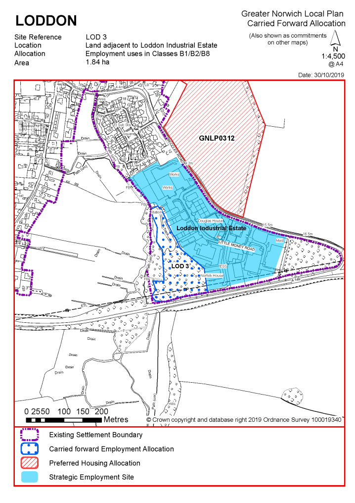
POLICY LOD 3 Land adjacent to Loddon Industrial Estate, Little Money Road, Loddon (approx. 1.84 ha) is allocated for employment uses in Classes B1/B2/B8.
The development will be expected to address the following specific matters:
|
Notes
LOD 3: The site was allocated in 2015 as part of the current local plan but has not yet been developed. The principle of development is already accepted and it is expected that development will take place within the new local plan time-period. The site is re-allocated for employment/commercial development.
|
Address |
Site Reference |
Area (ha) |
Promoted for |
Reason for not allocating |
|
Loddon and Chedgrave |
||||
|
NO REASONABLE ALTERNATIVE SITES
|
||||
Unreasonable Sites - Residential
|
Address |
Site Reference |
Area (ha) |
Promoted for |
Reason considered to be unreasonable |
|
Loddon and Chedgrave |
||||
| (6) | ||||
|
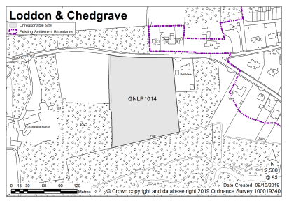
Land on the west side of Norwich Road, Chedgrave |
GNLP1014 |
1.60 |
Residential (unspecified number) |
This site is not considered to be suitable for allocation as it does not relate well to the form of the settlement and would appear as a separate enclave of development. |
|
|
||||
| (3) | ||||
|
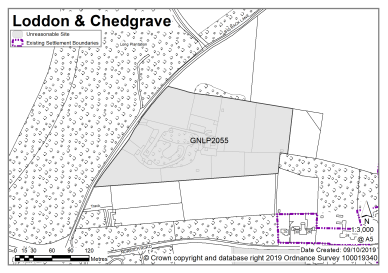
Big Back Lane, Chedgrave |
GNLP2055 |
3.45 |
Residential (unspecified number |
This site is not considered to be suitable for allocation as it does not relate well to the form of the settlement and would appear as a separate enclave of development. |
|
|
||||
| (1) | ||||
|
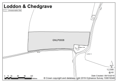
Wood Farm, Bungay Road, Loddon |
GNLP0008 |
2.01 |
Up to 15 dwellings including access roads |
This site is not considered to be suitable for allocation as it is located in open countryside, a considerable distance from any settlement, with no pedestrian access to any services. |
|
|
||||
| (2) | ||||
|
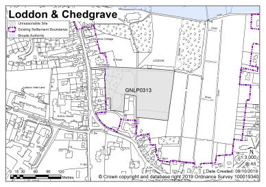
Land to east of High Street, Loddon |
GNLP0313 |
1.62 |
Approx. 68 dwellings |
This site is not considered to be suitable for allocation. Significant heritage concerns would be compounded by landscape impacts if trees had to be removed from the site. Crucially, there is no suitable vehicular access unless adjoining land at the fire station is included. |
|
|
||||
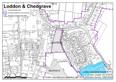
| (1) | ||||
|
Land off Low Bungay Road, Loddon |
GNLP0314 |
0.74 |
Approx. 19 dwellings |
This site is not considered to be suitable for allocation as it has inadequate vehicular access and no pedestrian footway to Loddon Infant and Junior Schools. |
|
|
||||
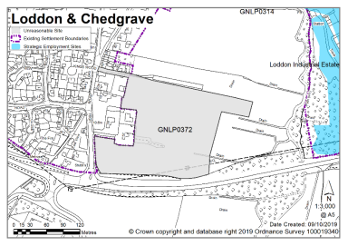
| (3) | ||||
|
Land to the east of High Bungay Road, Loddon |
GNLP0372 |
3.14 |
Approx. 130 dwellings plus a Scout Hut and public open space (an initial phase of 60 starter homes could be promoted on the southern section of the site) |
Although well-located in relation to the settlement, the site is not considered to be suitable for allocation as there are concerns regarding vehicular access onto High Bungay Road in close proximity to the A146. |
|
|
||||
| (2) | ||||
|
South of Beccles Road, Loddon |
GNLP2032 |
0.52 |
Residential (unspecified number) |
This site is not considered to be suitable for allocation. There is flood risk on part of the site which may affect the developable area. There are concerns regarding vehicular access; access would be suitable for a single dwelling only. There have also been a number of dismissed appeals on the site. |
|
|
||||
Unreasonable Sites - Non-Residential
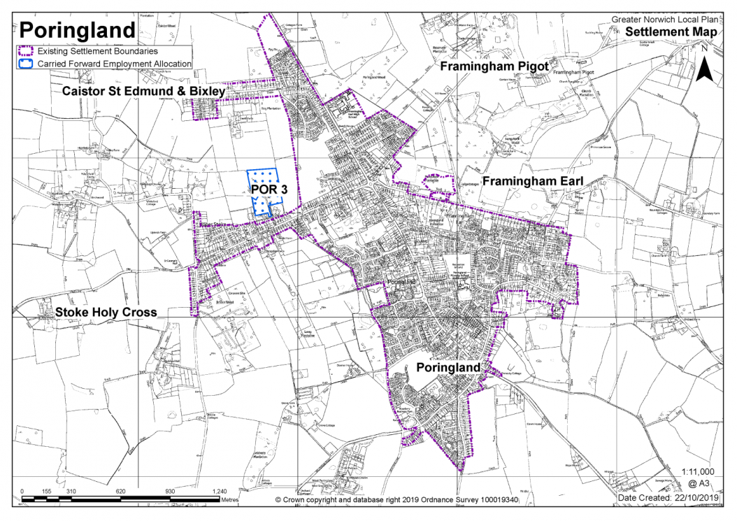
PORINGLAND, FRAMINGHAM EARL AND FRAMINGHAM PIGOT
(including well-related parts of Bixley, Caistor St Edmund and Stoke Holy Cross)
Poringland/Framingham Earl is identified as a key service centre in the GNLP. The village has a range of services including a post office, supermarket, other stores, pubs, restaurants/take-aways, two doctors' surgeries, a dentist, a primary school, a high school, two community halls, as well as recreation facilities at the High School and some local employment. The settlement is well connected to Norwich by bus.
A substantial amount of land continues to be promoted for development in Poringland/Framingham Earl (including land in adjacent parishes of Bixley, Caistor St Edmund, Framingham Pigot, Framingham Earl, and Stoke Holy Cross). Issues to take into account when assessing the potential for future development include the rural nature of large parts of the parishes, with the distinctive setting created by areas of heavily wooded former parkland. The 2012 South Norfolk Place Making Guide suggests that development should not further accentuate the linear settlement pattern. The settlement has a history of surface water and ground water drainage difficulties, and the most vulnerable sites were identified in an Urban Drainage Study. This issue will be a consideration for many sites in Poringland and Framingham Earl, and mitigation will be needed for any development on such sites. A Neighbourhood Plan is currently being prepared for Poringland parish and is at an advanced stage.
There are currently no new allocations proposed and no allocations to be carried forward in this key service centre. There are however 536 dwellings with planning permission on small sites.
All new and carried forward allocations are expected to address standard requirements associated with development. These vary from place to place but are likely to include mitigations for flood risk (as well as SUDs), highways improvements, safeguarding of minerals resources, land remediation, measures to protect the environment, biodiversity, and landscape intrusion.
(4) No new allocations are proposed
Notes
High amounts of existing commitments limit the potential for additional housing.
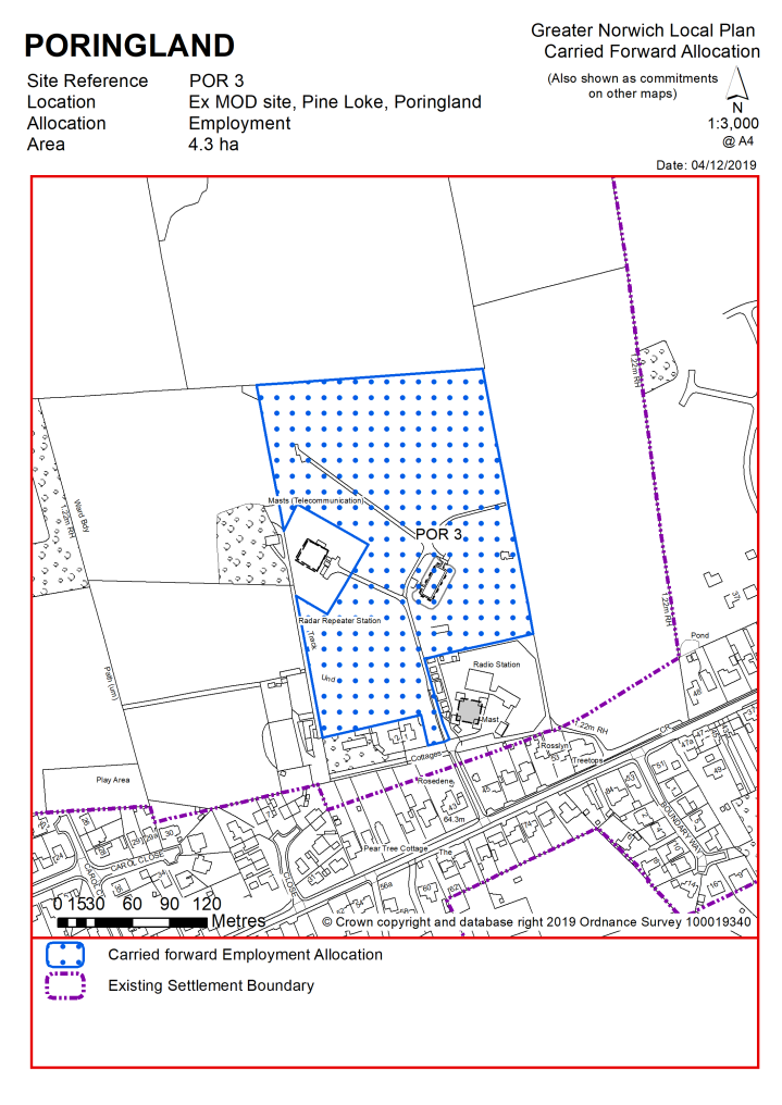
Existing allocation to be carried forward
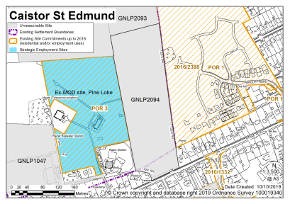
|
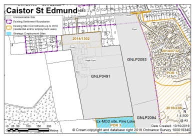
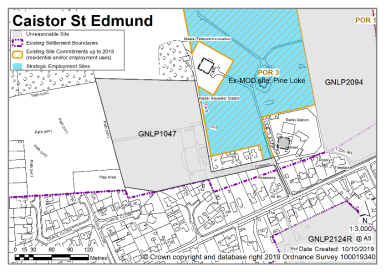
POLICY POR3 Ex MOD site, Pine Loke, Poringland (approx. 4.3 ha) is allocated for employment uses in Class B1.
The development will be expected to address the following specific matters:
|
Notes
POR3: The site was allocated in 2015 as part of the current local plan but has not yet been developed. The principle of development is already accepted and it is expected that development will take place within the new local plan time-period. The site sits beneath two radio masts which dominate the site and require access for maintenance. The site is therefore considered to be unsuitable for housing (or many other uses) and for this reason remains outside the development boundary. However, the site is re-allocated for light industrial uses compatible with the nearby residential and equestrian land uses.
|
Address |
Site Reference |
Area (ha) |
Promoted for |
Reason for not allocating |
|
Poringland, Framingham Earl and Framingham Pigot (including well related parts of Bixley, Caistor St Edmund and Stoke Holy Cross) |
||||
| (2) | ||||
|
NO REASONABLE ALTERNATIVE SITES – HIGH AMOUNTS OF EXISTING COMMITMENTS AND ENVIRONMENTAL/INFRASTRUCTURE CONSTRAINTS LIMIT THE POTENTIAL FOR ADDITIONAL HOUSING |
||||
Unreasonable Sites - Residential
|
Address |
Site Reference |
Area (ha) |
Promoted for |
Reason considered to be unreasonable |
|
Poringland, Framingham Earl and Framingham Pigot (including well related parts of Bixley, Caistor St Edmund and Stoke Holy Cross |
||||
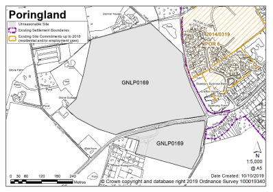
| (2) | ||||
|
Land north and south of Shotesham Road, Poringland |
GNLP0169 |
18.35 |
250-320 dwellings including an element of residential care, public open space and employment space |
This site is not considered to be suitable for allocation as development would be intrusive into open countryside to the west of the settlement. Significant highway improvements are required including a review of the Shotesham Road junction with Bungay Road with possible capacity works. High amounts of existing commitments and environmental/ infrastructure constraints limit the potential for additional new housing in Poringland. |
|
|
||||
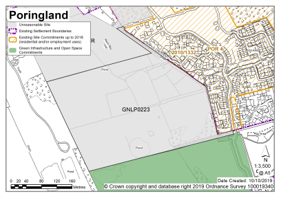
| (8) | ||||
|
Land North of Heath Loke and the west of The Street, Poringland |
GNLP0223 |
9.25 |
Residential development (unspecified number) |
This site is not considered to be suitable for allocation as vehicular access may be difficult without the development of adjacent sites or the availability of a suitable access from the new estate development immediately to the west. In addition, high amounts of existing commitments and environmental/ infrastructure constraints limit the potential for additional new housing in Poringland. |
|
|
||||
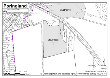
| (3) | ||||
|
Cherry Trees, south of Bungay Road, Poringland |
GNLP0280 |
2.17 |
Approx. 40 dwellings |
This site is not considered suitable for allocation as development would be intrusive into open countryside to the south of the settlement. It is unclear whether vehicular access to the site would require demolition of a dwelling, and there are concerns about creating a suitable access. In addition, high amounts of existing commitments and environmental/ infrastructure constraints limit the potential for additional new housing in Poringland. |
|
|
||||
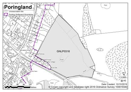
| (3) | ||||
|
Land north of Bungay Road, Poringland |
GNLP0316 |
4.92 |
Residential development (unspecified number) |
This site is not considered to be suitable for allocation as development would be intrusive into open countryside to the south of the settlement. It is unclear whether vehicular access to the site would require demolition of a dwelling, and there are concerns about creating a suitable access with an acceptable visibility splay onto the B1332. There is a significant band of surface water flood risk running through the site which could affect the developable area. In addition, high amounts of existing commitments and environmental/ infrastructure constraints limit the potential for additional new housing in Poringland. |
|
|
||||
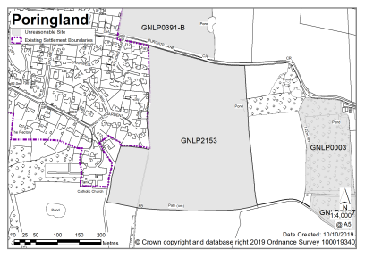
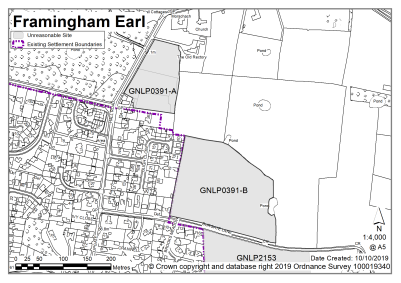
| (10) | ||||
|
South of Burgate Lane, Poringland |
GNLP2153 |
9.30 |
165 dwellings |
This site is not considered to be suitable for allocation as development would be intrusive into open countryside to the south-east of the settlement and would significantly adversely affect views of the landscape from the south. High amounts of existing commitments and environmental/ infrastructure constraints limit the potential for additional new housing in Poringland. |
|
|
||||
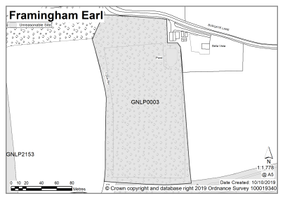
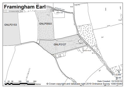
| (2) | ||||
|
Land adjacent (West of) Bella Vista, Burgate Lane, Framingham Earl |
GNLP0003 |
2.25 |
Residential development (unspecified number) |
This site is not considered to be suitable for allocation as it is separated from the settlement and would appear as an individual enclave of development. Development would be intrusive into open countryside, causing significant adverse landscape impact and highway concerns. In addition, high amounts of existing commitments and environmental/ infrastructure constraints limit the potential for additional new housing in Poringland |
|
|
||||
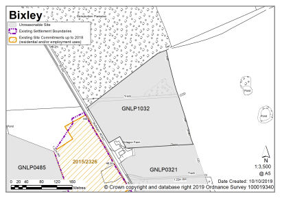
| (3) | ||||
|
Land immediately adjacent to Octagon Farm and adjacent fields, Bungay Road, Framingham Earl |
GNLP0321 |
4.28 |
Mixed use development consisting of approx. 60 dwellings, commercial, business and light industrial space. |
This site is not considered to be suitable for allocation as although there is a footpath and cycle link along the east side of the B1332 to local facilities there is relatively little development on the eastern side of the B1332. Development in this location would also impact on the setting of Octagon Barn. In addition, high amounts of existing commitments and environmental/ infrastructure constraints limit the potential for additional new housing in Poringland. |
|
|
||||
| (9) | ||||
|
Land at Framingham Earl, Burgate Lane |
GNLP0391 A & B |
4.60 |
Approx. 140 dwellings |
Neither of these sites are considered to be suitable for allocation. Roads serving both parts of GNLP0391 are narrow lanes considered unsuitable for serving additional development. Site B in particular would be intrusive into open countryside to the south-east of the settlement and would significantly adversely affect views of the landscape from the south. In addition, high amounts of existing commitments and environmental/ infrastructure constraints limit the potential for additional new housing in Poringland. |
|
|
||||
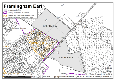
| (3) | ||||
|
Land North and South of Pigot Lane, Framingham Earl & Framingham Pigot |
GNLP0589 A & B |
10.02 |
Residential development (unspecified number) |
Despite being reasonably well located to the existing built form these sites are not considered to be suitable for allocation as high amounts of existing commitments and environmental/ infrastructure constraints limit the potential for additional new housing in Poringland. |
|
|
||||
| (2) | ||||
|
Orchard Farm, Framingham Earl |
GNLP2127 |
2.40 |
Residential development (unspecified number) |
This site is not considered to be suitable for allocation as it is separated from the settlement and would appear as an individual enclave of development. Development would be intrusive into open countryside, causing significant adverse landscape impact. High amounts of existing commitments and environmental/ infrastructure constraints limit the potential for additional new housing in Poringland. |
|
|
||||
| (3) | ||||
|
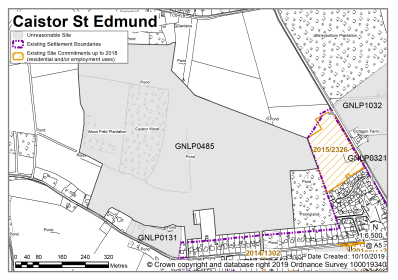
Land adjacent to and to the north of Octagon Farm, Bixley |
GNLP1032 |
4.20 |
Mixed use with commercial business use and approx. 100 dwellings, landscaping and infrastructure |
This site is not considered to be suitable for allocation as although there is a footpath and cycle link along the east side of the B1332 to local facilities there is relatively little development on the eastern side of the B1332. In addition, development would impact on the setting of Octagon Barn. There was some discussion over the site's potential if allocated with GNLP0321, but the majority of the site is affected by surface water flood risk which would significantly constrain the developable area. High amounts of existing commitments and environmental/ infrastructure constraints limit the potential for additional new housing in Poringland. |
|
|
||||
| (4) | ||||
|
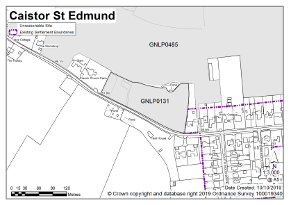
Land East of French Church Farm, Caistor Lane, Caistor St Edmund |
GNLP0131 |
1.23 |
Residential (Unspecified number) |
This site is not considered to be suitable for allocation due to highways constraints. The narrowness of the carriageway and the lack of a continuous footpath is compounded by the poor forward visibility for vehicles travelling around the adjacent bend on Caistor Lane. Another constraint is an area of surface water flood risk through the centre of the site. In addition, high amounts of existing commitments and environmental/ infrastructure constraints limit the potential for additional new housing in Poringland. |
|
|
||||
| (7) | ||||
|
Land North of Caistor Lane, Caistor St Edmund |
GNLP0485 |
36.33 |
Approx. 180 dwellings, proposed with 24ha for a new 'Caistor County Park' |
This site is not considered to be suitable for allocation due to highways constraints. Access from the west of the site would be very detrimental to the rural character of that section of Caistor Lane and the surrounding landscape. It is not clear what access arrangements exist to the east, via the development under construction (ref: 20120405). In addition, high amounts of existing commitments and environmental/ infrastructure constraints limit the potential for additional new housing in Poringland. |
|
|
||||
| (3) | ||||
|
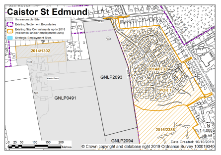
Land South of Caistor Lane, Caistor St Edmund |
GNLP0491 |
9.71 |
Residential (unspecified number) |
This site is not considered to be suitable for allocation due to highways constraints. There is no suitable access unless the site is allocated in junction with neighbouring land GNLP2093 or GNLP2094. In addition, high amounts of existing commitments and environmental/ infrastructure constraints limit the potential for additional new housing in Poringland. |
|
|
||||
| (1) | ||||
|
Pine Lodge School of Classical Equitation, Pine Loke, Caistor St Edmund |
GNLP1047 |
2.81 |
Mixed use (unspecified number) |
This site is not considered to be suitable for allocation due to highways constraints. There is no suitable access unless the site is allocated in junction with neighbouring land to the east (existing allocation POR3), GNLP2093 or GNLP2094. In addition, high amounts of existing commitments and environmental/ infrastructure constraints limit the potential for additional new housing in Poringland. |
|
|
||||
| (4) | ||||
|
South of Caistor Lane, Caistor St Edmund |
GNLP2093 |
5.50 |
150 dwellings |
This site is not considered suitable for allocation due to highways constraints. The junction at Caistor Lane with the B1332 is not of a suitable standard to accept traffic from development of that scale. Only infill frontage development might be acceptable. In addition, high amounts of existing commitments and environmental/ infrastructure constraints limit the potential for additional new housing in Poringland. |
|
|
||||
| (3) | ||||
|
North of Stoke Road, Caistor St Edmund |
GNLP2094 |
4.37 |
110 dwellings |
This site has some potential for allocation subject to acceptable access, footway provision, carriageway widening and pedestrian connectivity with POR1 and POR3. However, high amounts of existing commitments and environmental/ infrastructure constraints limit the potential for additional new housing in Poringland so therefore the site is not considered suitable for allocation. |
|
|
||||
| (3) | ||||
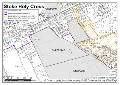
|
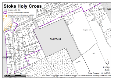
Land south of Poringland Road, Stoke Holy Cross |
GNLP0494 |
3.38 |
Residential development and 1.02 ha of green infrastructure comprising public open space, tree planting and new habitats |
This site is not considered to be suitable for allocation due to highways constraints. The access (which involves demolishing an existing property) is narrow. As well as the form of development caused by the narrow access, and achieving suitable visibility splays, there could be issues over the residential amenity to neighbouring properties. In addition, high amounts of existing commitments and environmental/ infrastructure constraints limit the potential for additional new housing in Poringland. |
|
|
||||
| (2) | ||||
|
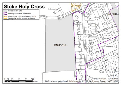
South of Long Lane, Stoke Holy Cross |
GNLP2111 |
2.89 |
50-60 dwellings |
This site is not considered to be suitable for allocation due to highways constraints. Concerns exist over the access and achieving an acceptable visibility splay due to the alignment of Long Lane. The site is also displaced from the settlement with sporadic footway connections which may require pedestrians to cross at a sub-optimal location. In addition, high amounts of existing commitments and environmental/ infrastructure constraints limit the potential for additional new housing in Poringland. |
|
|
||||
| (2) | ||||
|
Model Farm, Stoke Holy Cross |
GNLP2124R |
4.56 |
80 dwellings |
This site is not considered to be suitable for allocation due to highways constraints. It is not clear how the site could be accessed. Options could be via existing allocation POR4 but would probably require a private agreement. An alternative could be via the Ridings, depending on whether the site boundary is adjacent to the highway. In addition, high amounts of existing commitments and environmental/ infrastructure constraints limit the potential for additional new housing in Poringland. |
|
|
||||

Unreasonable Sites - Non-Residential
|
Address |
Site Reference |
Area (Ha) |
Proposal |
Reason considered to be unreasonable
|
|||||
|
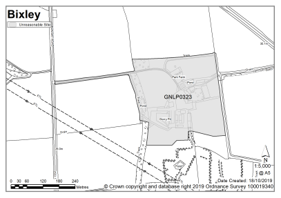
Poringland (including Bixley) |
|||||||||
| (1) | |||||||||
|
Park Farm, Bungay Road, Bixley |
GNLP0323 |
9.83 |
Employment & Commercial use |
This site is not considered to be suitable for allocation as evidence suggests that currently committed land is more than sufficient in quantity and quality to meet the employment growth needs in Greater Norwich. There is therefore no need to allocate any additional large-scale employment sites in the new local plan. Constraints on development include highways access, surface water flood risk on part of the site, and heritage issues to the setting of the Church of St Wandregelius (Grade II* listed). |
|||||
|
|
|||||||||
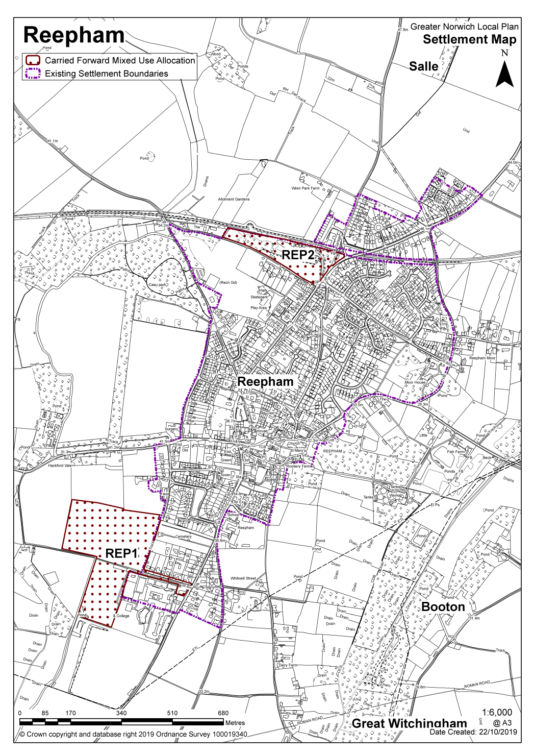
REEPHAM (including Booton, Guestwick, Heydon, Salle and Wood Dalling)
Reepham is identified as a key service centre. Services include a high school, primary school, shop, doctor's surgery, village hall, library, and public houses. Booton, Guestwick, Heydon, Salle and Wood Dalling are all identified as smaller rural communities in the countryside where there are no settlement limits and limited services and facilities.
There are currently no new allocations proposed in this key service centre. There are two carried forward residential allocations for 120 homes and a total of 28 additional dwellings with planning permission on small sites. This gives a total deliverable housing commitment for the centre of 148 homes between 2018 – 2038.
All new and carried forward allocations are expected to address standard requirements associated with development. These vary from place to place, but are likely to include mitigations for flood risk (as well as SUDs), highways improvements, safeguarding of minerals resources, land remediation, measures to protect the environment, biodiversity, and landscape intrusion.
No new allocations are proposed
Notes:
High amounts of existing commitments and environmental/infrastructure constraints limit the potential for additional housing.
Existing allocations to be carried forward
|
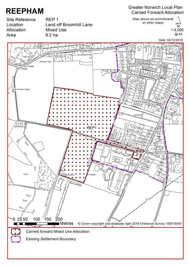
POLICY REP1 Land off Broomhill Lane, Reepham (approx. 8.2ha) is allocated for residential development & community facilities (including cemetery land, recreational open space and a sports hall). This comprises land to the north (approx. 5.7 ha) and south (approx. 2.5 ha) of Broomhill Lane, Reepham. The site will accommodate approximately100 homes in total. More homes may be accommodated, subject to an acceptable design and layout, as well as infrastructure constraints.
The development will be expected to address the following specific matters:
|
Notes
REP1: The site was allocated in 2016 as part of the current local plan but has not yet been developed. The principle of development is already accepted and it is expected that development will take place within the new local plan time-period up to 2038. The site is considered in the calculation of the housing requirement, providing at least 100 homes, but more may be accommodated, subject to an acceptable design and layout, etc. being achieved. REP1 will also be incorporated into the settlement limit once it is completed.
|
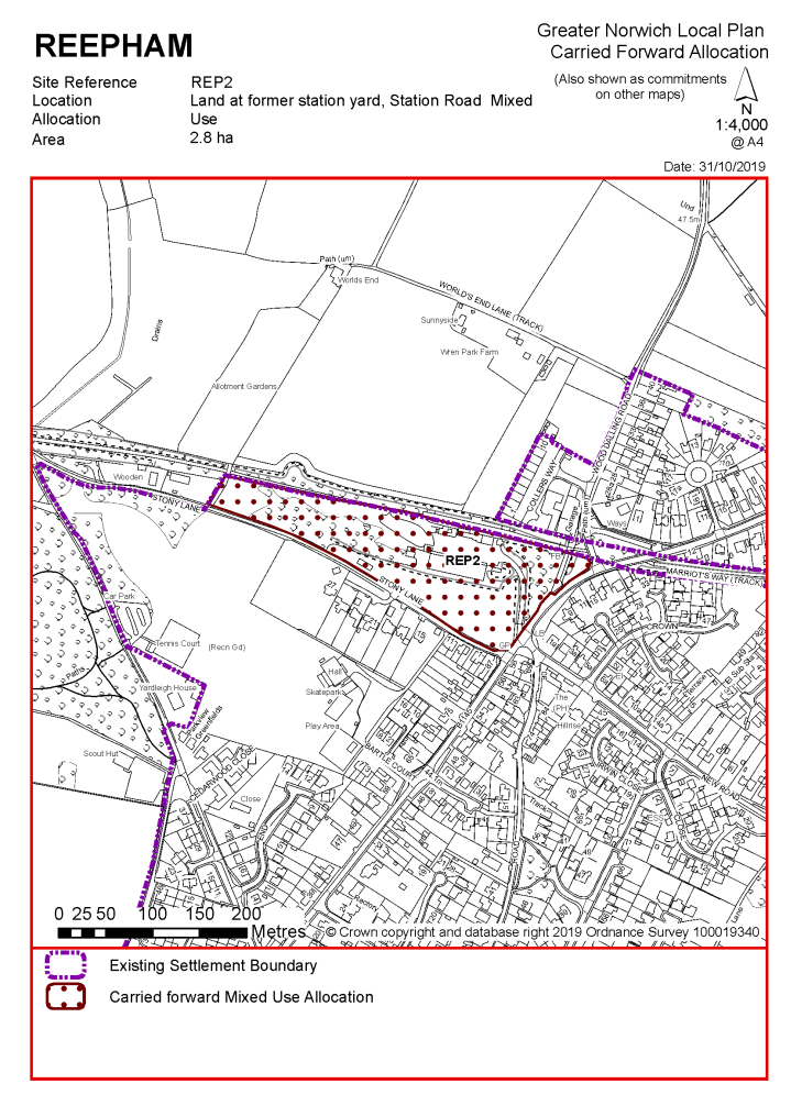
POLICY REP2 Land at former station yard, Station Road, Reepham (approx. 2.8 ha) is allocated for a mixed development of residential and employment. This will accommodate approximately 20 homes, B1 and B2 employment uses.
More homes may be accommodated, subject to an acceptable design and layout, as well as infrastructure constraints.
The development will be expected to address the following specific matters:
|
Notes
REP2: The site was allocated in 2016 as part of the current local plan but has not yet been developed. The principle of development is already accepted and it is expected that development will take place within the new local plan time-period up to 2038. A planning permission exists for the site (reference: 20180963) that if developed will provide for a 60 bed care home and 20 assisted flats and 15 assisted bungalows. REP2 will also be incorporated into the settlement limit once it is completed.
|
Address |
Site Reference |
Area (ha) |
Promoted for |
Reason for not allocating |
|
Reepham (Booton, Guestwick, Heydon, Salle and Wood Dalling) |
||||
|
NO REASONABLE ALTERNATIVE SITES – HIGH AMOUNTS OF EXISTING COMMITMENTS AND ENVIRONMENTAL/INFRASTRUCTURE CONSTRAINTS LIMIT THE POTENTIAL FOR ADDITIONAL HOUSING
|
||||
Unreasonable Sites – Residential
|
Address |
Site Reference |
Area (ha) |
Promoted for |
Reason considered to be unreasonable |
|
Reepham (Booton, Guestwick, Heydon, Salle and Wood Dalling) |
||||
| (1) | ||||
|
Land off the Wood Dalling Road (adjacent to Collers Way) |
GNLP0096 |
0.70 |
15 dwellings |
This site could have potential for development if Wood Dalling Road was widened to 5.5m along with a 2m frontage footway between the access and southwards to Colliers Way. However, the site is not considered to be suitable for allocation as it has potential landscape impacts and high amounts of existing commitments and environmental/ infrastructure constraints limit the potential for additional new housing in Reepham. |
|
|
||||
| (1) | ||||
|
Land north of Whitwell Street |
GNLP0180 |
1.70 |
35 dwellings |
This site is not considered to be suitable for allocation due to limitations in the highway network. In addition, high amounts of existing commitments and environmental/ infrastructure constraints limit the potential for additional new housing in Reepham. |
|
|
||||
| (1) | ||||
|
Land east of Whitwell Road |
GNLP0183 |
3.50 |
65-70 dwellings |
This site is not considered to be suitable for allocation due to highway constraints. A footway is required to link with the town centre but there is not sufficient space to enable this to the north of site. In addition, high amounts of existing commitments and environmental/ infrastructure constraints limit the potential for additional new housing in Reepham. |
|
|
||||
| (1) | ||||
|
Land off Norwich Road |
GNLP0221 |
0.66 |
5 or more dwellings |
This site is not considered to be suitable for allocation as there is no pedestrian footway to access facilities in the town, such as the schools. In addition, high amounts of existing commitments and environmental/ infrastructure constraints limit the potential for additional new housing in Reepham. |
|
|
||||
| (2) | ||||
|
Land north and south of the B1145 and Dereham Road |
GNLP0353 |
11.67 |
100-200 dwellings |
This site is not considered to be suitable for allocation on highway grounds. The footway from the east of the site to the town centre is narrow and not suitable for an increased number of users with no scope for improvement. The B1145 vertical alignment and presence of mature trees reduce certainty the acceptable visibility distances could be achieved. In addition, high amounts of existing commitments and environmental/infrastructure constraints limit the potential for additional new housing in Reepham. |
|
|
||||
| (1) | ||||
|
Land adjacent Wood Dalling Road |
GNLP0543 A & B |
1.34 |
10-35 dwellings |
These sites are not considered to be suitable for allocation. As well as landscape impacts, there are highway constraints and it does not appear feasible to extend pedestrian and cycle facilities to the site or to improve Wood Dalling Road to an acceptable standard. There is an area of surface water flood risk on GNLP0543A which would affect the developable area. In addition, high amounts of existing commitments and environmental/infrastructure constraints limit the potential for additional new housing in Reepham. |
|
|
||||
| (1) | ||||
|
Orchard Lane |
GNLP2026 |
0.63 |
5 dwellings |
This site is not considered to be suitable for allocation as it is accessed via a single-track road without footways so there is no safe walking route to school. In addition, high amounts of existing commitments and environmental/infrastructure constraints limit the potential for additional new housing in Reepham. |
|
|
||||
| (1) | ||||
|
Cawston Road |
GNLP2075 |
7.34 |
Residential (unspecified number) |
This site is not considered to be suitable for allocation. As well as landscape impacts, there are highway constraints and it does not appear feasible to extend pedestrian and cycle facilities to the site. In addition, high amounts of existing commitments and environmental/infrastructure constraints limit the potential for additional new housing in Reepham. |
|
|
||||
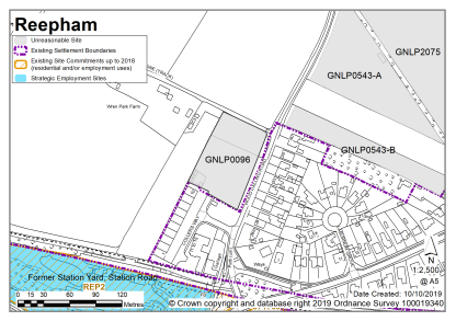
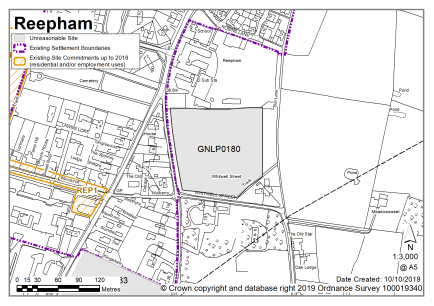
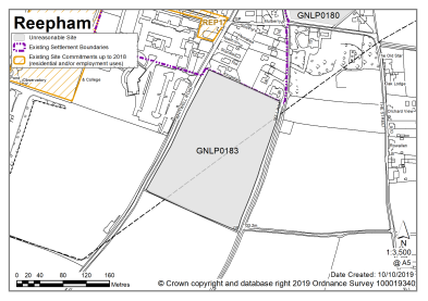
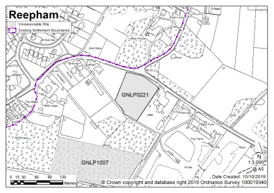
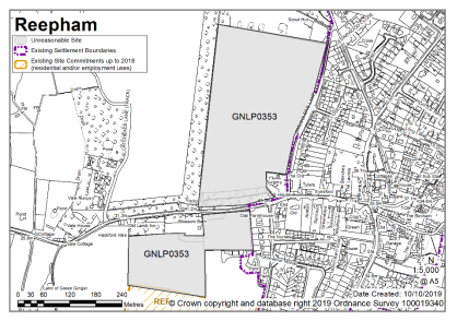
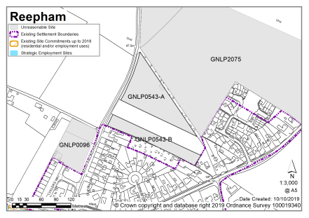
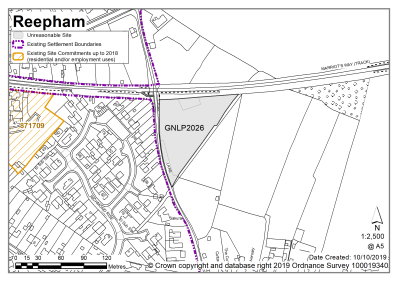
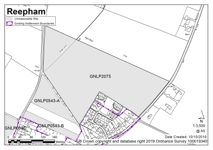
Unreasonable Sites - Non-Residential
|
Address |
Site Reference |
Area (Ha) |
Proposal |
Reason considered to be unreasonable
|
||
|
Reepham |
|
|
|
|
||
| (1) | ||||||
|
The Old Rectory Meadow, Reepham |
GNLP1007 |
1.69 |
Infrastructure extension |
This site is not preferred for allocation as no identified need exists and this proposal could be dealt with by a planning application if needed. |
||
|
|
||||||
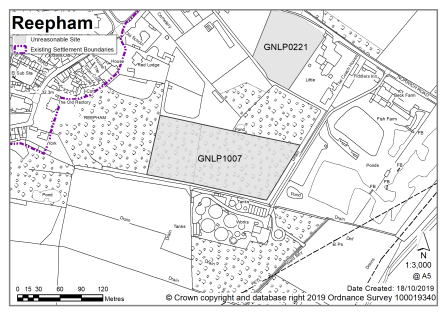
Wroxham is identified as a key service centre. Albeit shared with neighbouring Hoveton, services include a high school, primary school, shops, doctor's surgery, village hall, and library.
Wroxham Neighbourhood Plan was 'made' in March 2019 and covers the period to 2039. The vision for the Wroxham Neighbourhood Plan is for Wroxham parish to remain a unique and beautiful waterside community. It will have a variety of good quality homes to meet strategic and local needs, improved community services, effective traffic management, and a range of businesses, developed in ways that are sensitive to its iconic location and the Conservation Area.
There are currently no new allocations proposed and no allocations to be carried forward in this key service centre. There are however 4 dwellings with planning permission on small sites.
All new and carried forward allocations are expected to address standard requirements associated with development. These vary from place to place, but are likely to include mitigations for flood risk (as well as SUDs), highways improvements, safeguarding of minerals resources, land remediation, measures to protect the environment, biodiversity, and landscape intrusion.
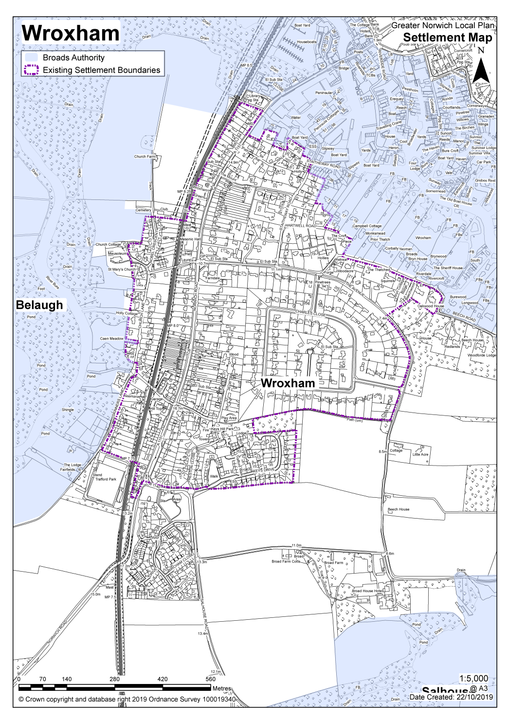
No new allocations are proposed
No existing allocations to be carried forward
Notes
Traffic constraints and Wroxham's proximity to the Broads restricts growth. The now completed 'Wherry Gardens' development will be incorporated into the settlement limit.
|
Address |
Site Reference |
Area (ha) |
Promoted for |
Reason for not allocating |
|
Wroxham |
||||
|
NO REASONABLE ALTERNATIVE SITES – TRAFFIC CONSTRAINTS AND PROXIMITY TO THE BROADS RESTRICT GROWTH
|
||||
Unreasonable Sites – Residential
|
Address |
Site Reference |
Area (ha) |
Promoted for |
Reason considered to be unreasonable |
|
Wroxham |
||||
| (2) | ||||
|
Wroxham Football Club, Trafford Park 35 Skinners Lane |
GNLP0041 |
1.81 |
20 dwellings |
The site remains in active use for Wroxham Football Club and although a potential replacement site has been identified this is not definite. Relocating the football club would require substantial investment, likely to be significantly more than would be achieved by redevelopment of the current ground and for that reason the site is considered to be unreasonable for allocation at the current time. In addition, traffic constraints and proximity to the Broads restricts additional growth in Wroxham. |
|
|
||||
| (3) | ||||
|
East of Salhouse Road |
GNLP2131 |
5.54 |
100 dwellings |
This site could have potential for allocation subject to rationalisation of the Salhouse Road junction with Preston Close and Keys Drive, along with an acceptable access strategy. There is a safe route to school, although the site is at the limits of an acceptable distance. However. the site is not considered to be suitable for allocation as it is considered that traffic constraints and proximity to the Broads restricts additional growth in Wroxham. |
|
|
||||
| (2) | ||||
|
South of Wherry Gardens |
GNLP2135 |
5.90 |
100 dwellings |
This site is adjacent to the existing allocation, there is a safe route to school but the site is at the limits of an acceptable distance. The site is not considered to be suitable for allocation as it would result in a significant southwards elongation of development into the countryside. The site also has an unbalanced development frontage and would require inappropriate extension to the speed limit and visibility requirements which would be excessive to mitigate risk. In addition, traffic constraints and proximity to the Broads restricts additional growth in Wroxham. |
|
|
||||